The Scablands Floods
Steven Dutch, Professor Emeritus, Natural and Applied Sciences, University of Wisconsin - Green Bay
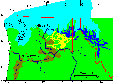 |
Geography of Washington during the Pleistocene. Ice is light blue, non-glaciated areas are green. Rivers are dark blue, large glacial lakes are medium blue. Scablands are yellow, and other areas flooded by the Missoula floods are in brown. |
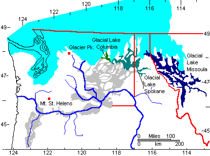 |
Flooding begins when the ice dam blocking Glacial Lake Missoula bursts.
Water from Glacial Lake Missoula spills into Glacial Lake Spokane |
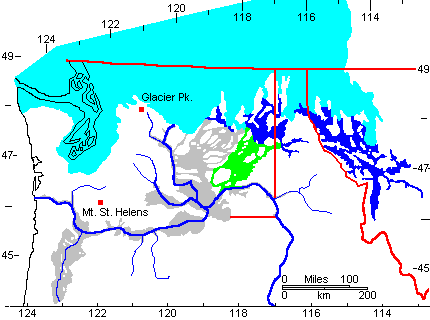 |
In the earliest floods, Lake Spokane overflows the Snake River drainage divide. These channels are called the Cheney-Palouse channels. |
 |
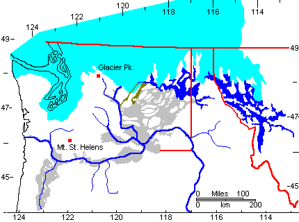
As ice retreat exposes lower outlets, the level of Glacial Lake Spokane drops. Somewhat later floods spill westward. These channels are called the Telford-Crab Creek channels. |
 |
Still later floods cut Moses and Grand Coulees |
 |
The very last floods pour down the Columbia River after the last ice blockage retreats. |
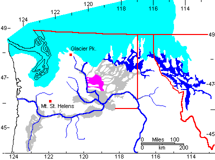 |
The west-flowing floods pond up to fill and overflow the Quincy Basin (purple) |
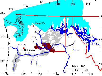 |
Flood waters next ponded up in the Pasco Basin and Yakima Valley (brown). The basins flood as water is impeded by the choke point at Wallula Gap.
Wallula Gap is "only" two miles wide, an indication of just how much water the floods contained. |
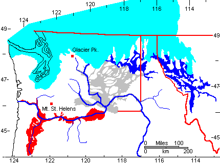 |
The last stages of flooding inundated the lower Columbia River and Williamette Valley. |
Return to 296-202 Visuals Index
Return to Professor Dutch's Home Page
Created 26 March, 2002; Last Update 14 January 2020
Not an official UW-Green Bay site