Physical Geology Slides - Wind Erosion
Steven Dutch, Professor Emeritus, Natural and Applied Sciences, University of Wisconsin - Green Bay
 |
Some of the best examples of wind erosion are found in Antarctica, where no other processes are active. These boulders have all been deeply eroded on the right by the prevailing winds. |
 |
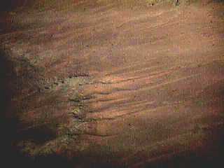
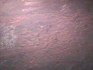
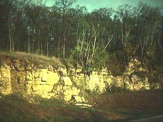
A typical wind-abraded outcrop, Butler Rock, Marinette County. Typical features: fluting, high polish, gentle but extremely sharp ridges. |
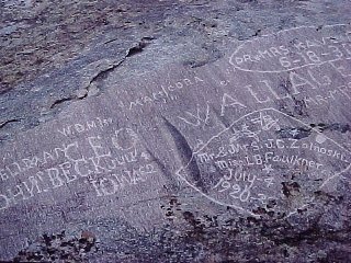 |
This polished and fluted surface atop Independence Rock, Wyoming can only have been shaped by wind. It's too high to be the result of water and was never glaciated.
How old does graffiti have to be before it stops being vandalism and becomes a historical relic? The "IOWA62" at lower left refers to 1862. Independence Rock was so named because travelers on the Oregon Trail tried to get here by July 4 to be sure of crossing the mountains before autumn snows began. |
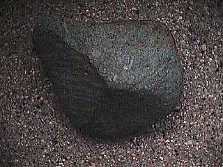 |
Wind-abraded rocks are often called dreikanters from a South African word meaning "three corners." Ventifacts are common in the U.S., once you know what to look for. This perfect dreikanter was found at River Falls, Wisconsin. Most ventifacts in the northern U.S. formed during the Pleistocene when vegetation was sparse and wind-blown sand and silt was abundant. |
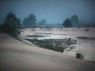 |
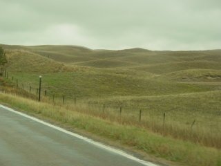
The largest deflation basin in Wisconsin is near Spring Green along the Wisconsin River flood plain. |
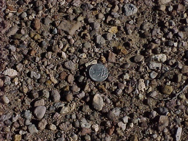 |
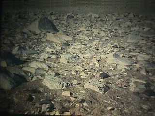
Many deserts are covered with desert pavement, created when wind blows fine material away, leaving coarse material behind. This deposit is upwind from Great Sand Dunes (below).
A deposit of heavy material left behind when light material is carried away is called a lag deposit. Lag deposits can be created by wind, running water, and wave action. |
 |
A "desert" pavement forming in a gravel pit near Hastings, Minnesota. |
 |
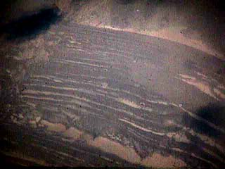
These longitudinal dunes in Colorado formed when sand dropped off the mesa to the left and collected in the lee of rocky |
 |
Dunes are often hybrids of several types. In this aerial view, these dunes in Colorado are partially longitudinal (lower left to upper right) and partially transverse. |
 |
Beach dunes on the shore of Lake Michigan |
 |
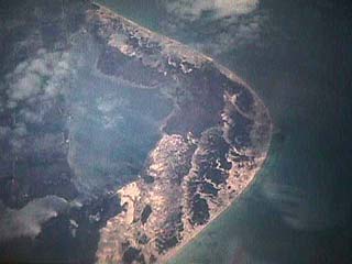
The largest dune fields in the U.S. are in, of all places, Nebraska. The Sand Hills cover much of western Nebraska. They formed during the Pleistocene from glacial debris eroded out of the Rockies, and exhibit just about every type of dune. Here we see transverse dunes several hundred meters wide and a kilometer or so long. |
 |
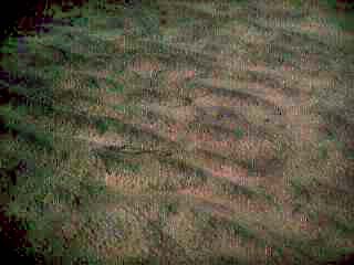
These dunes in the Nebraska Sand Hills are barchan-like but much bigger and more closely-spaced than most barchans. They are several hundred meters in size. |
 |
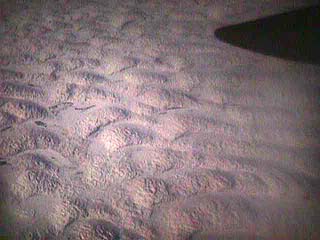
Typical appearance of Nebraska Sand Hills country. The land is mostly used for grazing and is sparsely settled. |
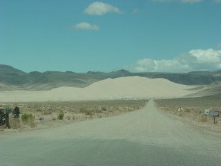 |
This dune east of Fallon, Nevada, formed from sand blown across a wide valley. Wind funnels through the low pass, but cannot carry the sand with it. |
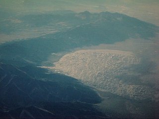 |
The highest sand dunes in the U.S. are Great Sand Dunes in Colorado. Wind blows sand from the right but cannot carry it over the mountains as air funnels through a low pass. The peaks in the foregrouns and the distance are over 14,000 feet but the pass is only 9,000. |
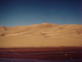 |
The highest dunes in Great Sand Dunes National Monument are over 200 meters high. |
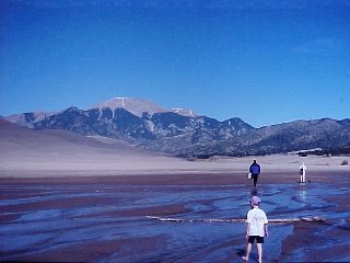 |
The most user-friendly wilderness area around. The area beyond the stream is perhaps the only designated wilderness area you can walk to in your bare feet.
The bare peak is over 14,000 feet and is in the foreground of the aerial photo above. The low pass to the right is about 9,000 feet. Wind blows sand across a broad basin but cannot carry it over the pass. The small stream catches most of the sand that lands east of the dunes and returns it to the basin to be blown again. |
 |
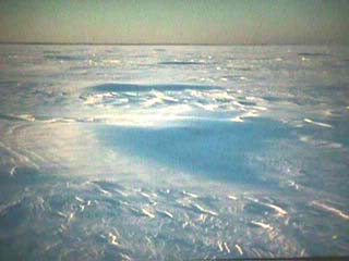
Every type of dune can also from in snow, but good barchans are rare. These formed near Bay Settlement, Wisconsin in January, 1997 as snow blew across a frozen crust. |
 |
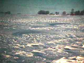
A barchan snow drift on bay ice off Communiversity Park in Green Bay, Wisconsin. The blowing snow shows the air flow over the dune. Wind chill was about -60 when the picture was taken. My dog, smarter than his master, hunkered down in a ball and stayed put. |
 |
Wind-blown sand has piled against old beach terraces on the eastern side of former Lake Bonneville in Utah, outlining them clearly. |
 |
The cap on these bluffs along the Mississippi near Alma, Wisconsin is loess, blown from the Mississippi River flood plain during the Pleistocene. |
Return to Course Notes Index
Access class notes on wind erosion
Return to Professor Dutch's Home Page
Created 13 August 1998, Last Update 31 August 1998