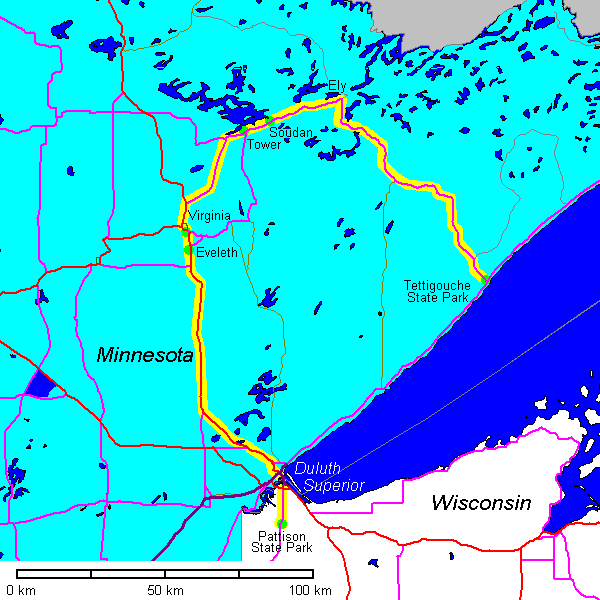
Soils and Geology of Wisconsin Field Trip, May 2007
Steven Dutch, Professor Emeritus, Natural and Applied Sciences, University of Wisconsin - Green Bay
May 17, 2007
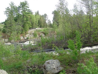
Irvine Park, Chippewa Falls
 |
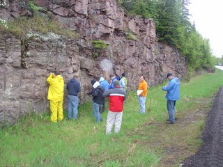
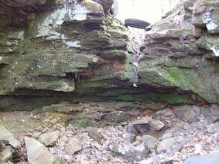
In 2005 getting to this spot was a nasty exercise in jungle warfare because of recently fallen trees. The situation was much improved two years later. Here, Cambrian sandstone overlies Archean granite.
Below at right is the contact showing the weathered zone atop the granite. |
 |
 |
 |
East of the contact are cliffs of Cambrian sandstone. |
 |
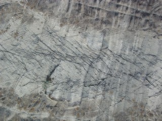
Calcareous cement in the sandstone shows signs of solution. |
 |
Nice truncated cross-beds. |
 |
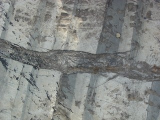
Liesegang bands in the sandstone. |
Amnicon Falls State Park
 |
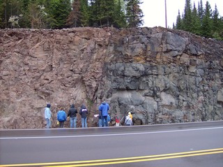
Amnicon Falls is created by the Douglas Fault juxtaposing Keeweenawan volcanic rocks and sedimentary rocks. |
 |
The fault is in the gully. There are at least five fault strands where slivers of conglomerate alternate with sandstone and siltstone. The floor of the gully is a band of conglomerate. It is in fault contact on the right with volcanic rocks. On the left it is in fault contact with horizontally bedded sandstone. |
 |
Professor Luczaj points to a fault sliver of conglomerate, which is in fault contact with horizontally bedded sandstone. |
 |
View of one of the fault strands. |
Big Manitou Falls, Pattison State Park
 |
The Douglas Fault forms a prominent scarp because it juxtaposes hard volcanic rocks with soft sedimentary rocks. Since the scarp is erosional, not due to actual displacement, it is not a fault scarp. Such a scarp is sometimes called a fault-line scarp. |
 |
Approaching the Douglas Fault. |
 |
Big Manitou Falls, 50 meters high, is the highest waterfall in Wisconsin. |
 |
Looking into the gorge of Big Manitou Falls. |
 |
Downstream from the falls are pink Keeweenawan sandstone. The water was too high (not dangerous, just inconvenient) to allow us to get close to the contact (which is concealed anyway but with good enough exposures to interpret relationships.) |
May 18, 2007
Mesabi Range, Eveleth, Minnesota
 |
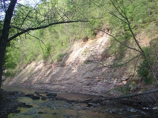
Middle Proterozoic iron formation on a highway cut on the outskirts of Eveleth. |
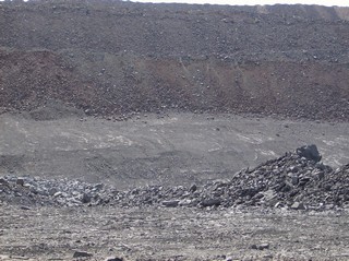 |
In an active mine. The iron ore here has been excavated away. The smooth slope is the top of the next formation down, and the bank above it is waste rock used to backfill the pit. |
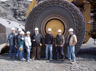 |
Tire, $100,000. Chain to protect it from wear, $40,000. Group photo, priceless. |
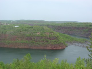 |
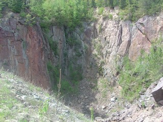
An overlook near Virginia offers views into a chain of abandoned pits. |
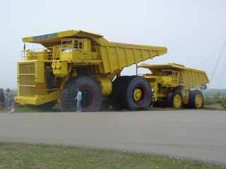 |
My truck can eat your truck. |
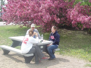 |
Lunch at the overlook. |
Soudan Iron Mine, Minnesota
 |
Soudan was actually one of the first iron mines in the region, but it mined Archean formations completely different from the Proterozoic Mesabi Range.
Originally the iron mines at Soudan were open pit, but when it became clear the ore continued underground, the pits were abandoned in favor of underground mining. |
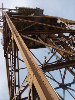 |
View of the headframe. |
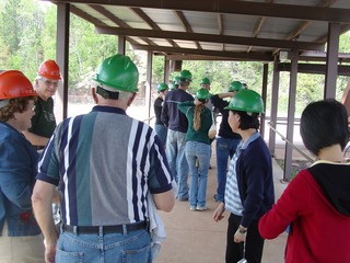 |
Now a state park, the Soudan mine offers underground tours. |
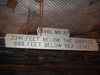 |
At the bottom. Half a mile below the surface, and roughly level with the deepest point in Lake Superior. |
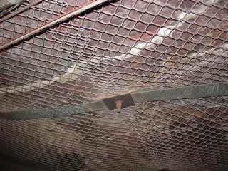 |
Rock bolts and mesh are standard stabilization measures in underground mines. |
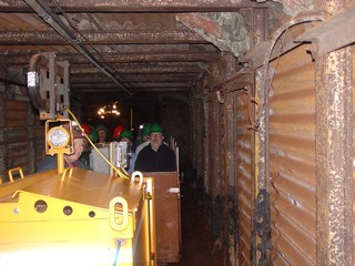 |
An electric locomotive takes visitors to the working face. |
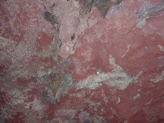 |
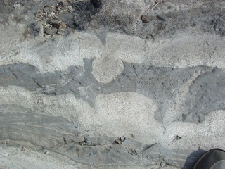
Some of the iron ore. |
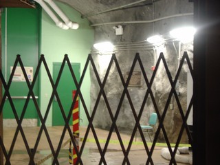 |
This uncharacteristically modern looking area is the entrance to a neutrino laboratory. Particle accelerators at Brookhaven Labs in Illinois fire neutrinos through 400 miles of rock to be detected here.
This is a state park so collecting of neutrinos is prohibited. They search. |
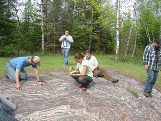 |
The iron ore is exposed in a couple of spectacular outcrops a short distance east of the mine. Note that there is not a scrap of loose rock on this outcrop. |
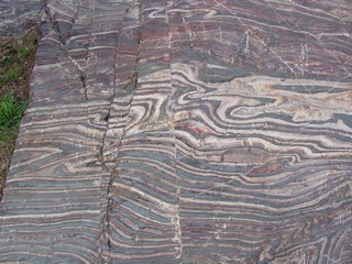 |
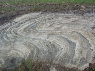
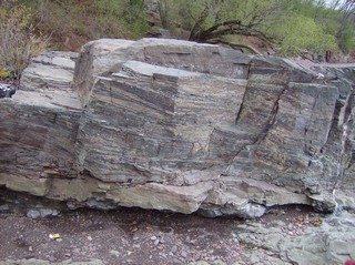
The iron formation is spectacularly colored and folded. |
Archean Graywacke Near Tower
 |
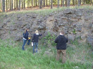
Near Tower are beautiful cleaned outcrops of Archean graywacke with some of the best graded bedding anywhere. Here we have some excellent load casts. But they're pointing in opposite directions! |
 |
And here's why: isoclinal folding. |
 |
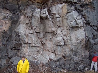
Not far away at this dam are more Archean graywackes. These are not folded at all (suggesting that the folding only a few kilometers away is highly localized, possibly soft-sediment) but show wonderful examples of the evolution of brittle shear zones. |
 |
 |
 |
It's a ways yet to our camping stop at Tettegouche State Park on the lake, so we get pizza to go for supper in Ely. |
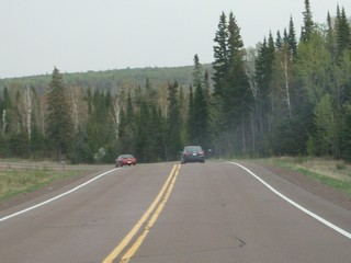 |
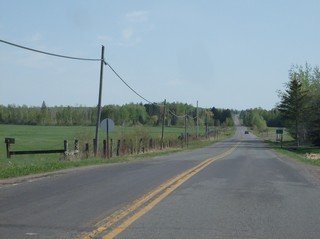
It looks short on the map but it's a windy, hilly road. |
May 19, 2007
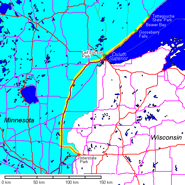
Tettegouche to Beaver Bay
 |
Rhyolite just off Highway 61. |
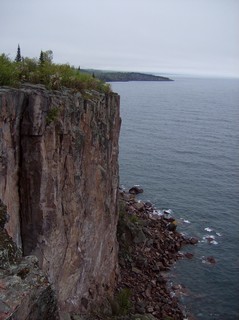 |
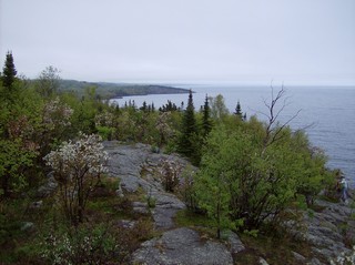
Rhyolite cliffs on the lakeshore at Palisade Head. Shovel Point is in the distance. |
 |
 |
 |
Obvious fault a few kilometers south of Tettegouche State Park. |
 |
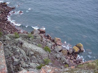
At Beaver Bay there are huge anorthosite inclusions in the gabbro. |
Gooseberry Falls State Park, Minnesota
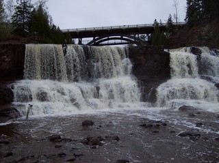 |
A wonderful waterfall right off Highway 61. |
 |
The several shelves that define the falls are formed by flow tops. Pahoehoe texture is visible here. |
 |
There are numerous small potholes in the basalt. |
Sedimentary Interbeds, Duluth, Minnesota
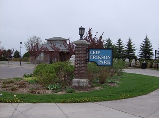 |
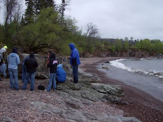
Leif Erikson Park in Duluth has a nice small outcrop of Keeweenawan sedimentary interbeds within the volcanic rocks. |
 |
For those of you who didn't know Leif Erikson got as far as Duluth. |
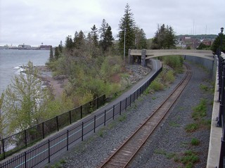 |
A bridge over the tracks leads to the beach. |
 |
The sedimentary outcrop is small but has excellent cross bedding. |
 |
May in Duluth. |
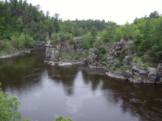
Interstate Park, Minnesota
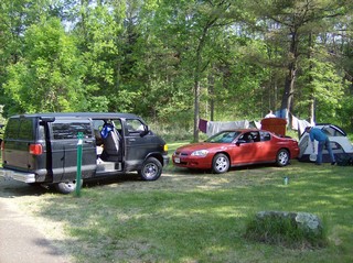 |
By the time we got to Interstate Park, the weather had cleared nicely. First order of business was to set up camp on the Wisconsin side. |
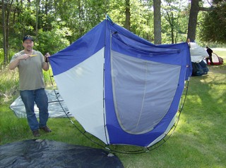 |
It didn't look like this on the carton!
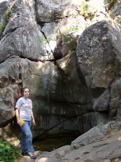
After setting up camp, we headed over to the Minnesota side to see the spectacular glacial potholes. |
 |
 |
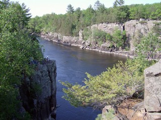 |
Looking across the Dells of the St. Croix to Wisconsin. |
Cambrian-Proterozoic Unconformity
 |
Across the highway from the Minnesota park headquarters, a deep valley leads to an excellent unconformity between the Cambrian sandstones and the Keeweenawan basalts. |
 |
Sacrifices to the mosquito gods. |
 |
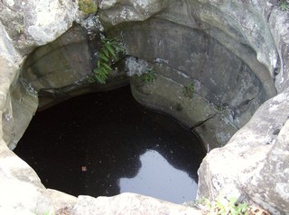
The unconformity is about 500 meters up the valley. Bedded sandstones on top of massive gray basalt. |
 |
Close up of the unconformity.
We first though it must have been a good year when that tire was deposited, but after thinking about its location, we decided it can only be a Bridgestone. |
May 20, 2007
Interstate Park, Wisconsin
 |
The Wisconsin side is less visited than the Minnesota side but still has lots of interesting geology. Here are the Dells from the Wisconsin side. |
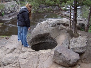 |
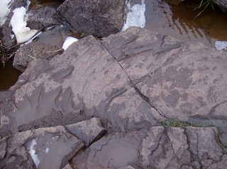
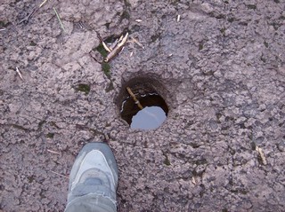
The most spectacular pothole on the Wisconsin side is this one. How you get a pothole on a knob like this is a mystery. |
 |
"His high exaltedness, the Great Jabba the Hutt, has decreed that you are to be terminated immediately. You will therefore be taken to the Dune Sea, and cast into the pit of Carkoon, the nesting place of the all-powerful Sarlaac. In his belly you will find a new definition of pain and suffering as you are slowly digested over a thousand years." |
 |
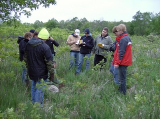
Water collects at the Cambrian-Keeweenawan unconformity and seeps out to create a small wetland floored by histosols, as Dr. Fermanich explains. |
Willow River State Park, Wisconsin
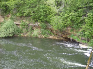 |
Dipping Cambrian sandstones below the dam. |
 |
The dam and dipping sandstones. |
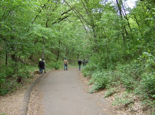 |
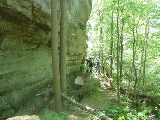
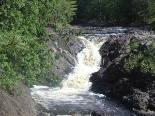
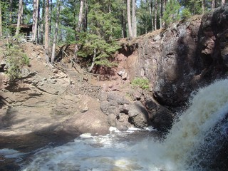
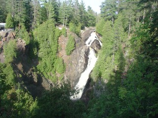
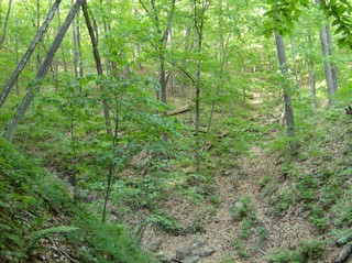
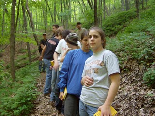
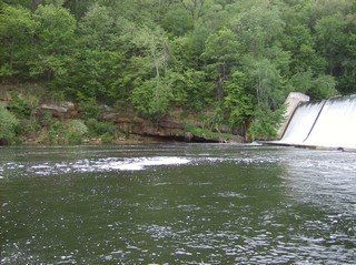
A few kilometers upstream, a trail leads through a deep valley, almost entirely cut into Pleistocene materials, to one of the nicest waterfalls in Wisconsin. |
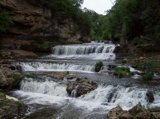 |
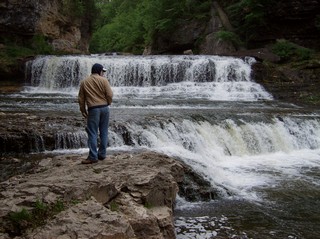 |
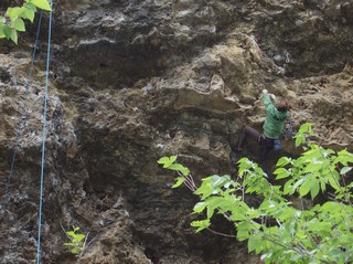 |
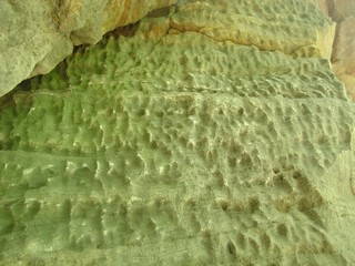
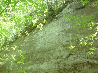
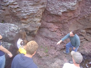
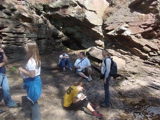
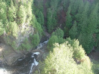
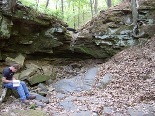
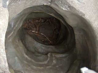
Here the rocks are cavernous Prairie du Chien dolomite. The cliffs are popular with rock climbers.
Between the dam and this locality is a fault with about 100 meters of offset. |
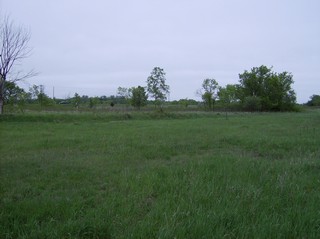 |
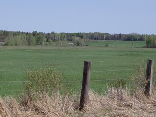
The flat landscape here contrasts sharply with the wide tract of hilly moraine to the north. |
 |
Examining the soils, which to nobody's surprise are mollisols. |
Return to Professor Dutch's Home Page
Created 08 September 2006, Last Update 15 January 2020