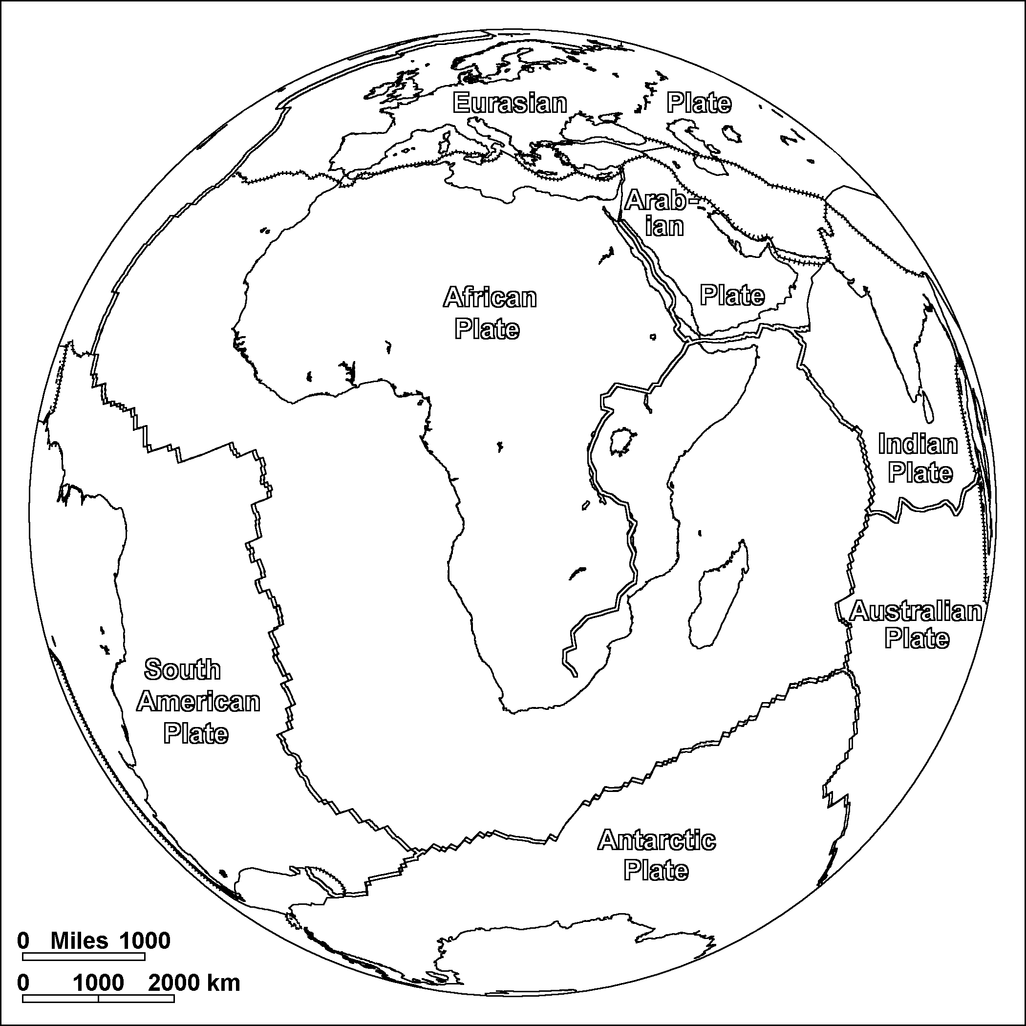
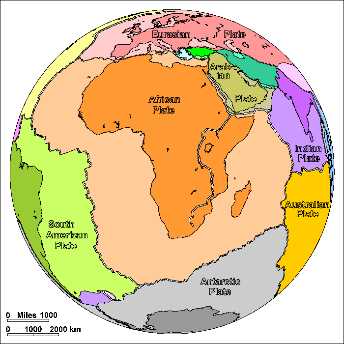
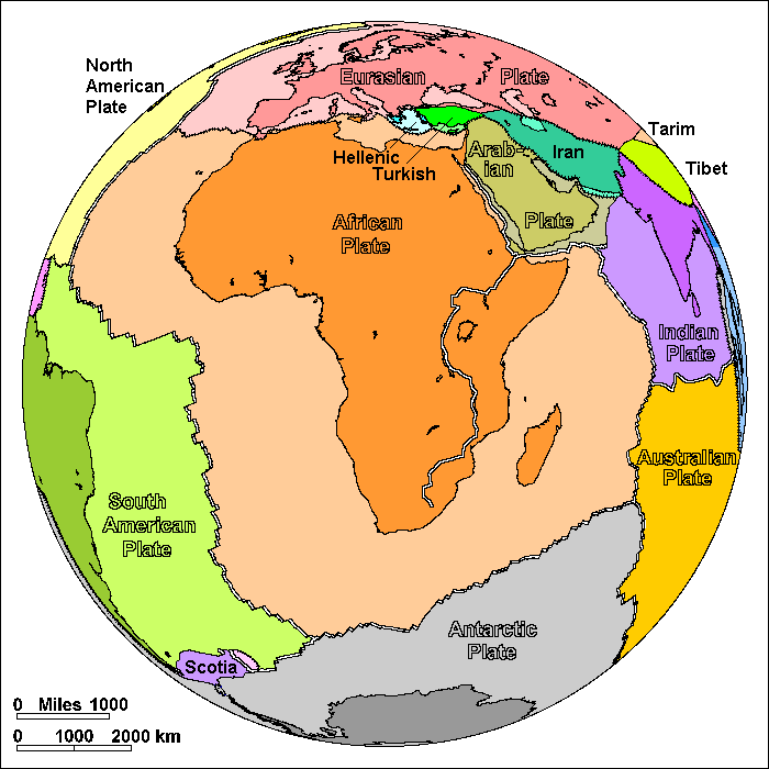
African Plate
Steven Dutch, Professor Emeritus, Natural and Applied Sciences, University of Wisconsin - Green Bay
On these diagrams, pairs of parallel lines show boundaries where plates are spreading apart, lines with ticks show boundaries where plates are colliding, and simple lines show other types of boundary. These include places where plates are simply sliding past one another, places where motions are too complex to portray simply, and places where new plate boundaries may be forming.
Africa was the center of Pangaea. South America, Antarctica and India broke away from it leaving it surrounded on three sides by divergent plate boundaries. Only on the north is Africa converging on other plates.
The earth has two kinds of crust. The continents are mostly made of thick granite. When continents pull apart, the gap is filled by thin crust made of basalt. In plate tectonics, a continent is any piece of continental crust surrounded by oceanic crust or plate boundaries. Madagascar is a continent. When Africa and eastern Gondwanaland (India, Antarctica and Australia) began to pull apart about 120 million years ago, Madagascar originally moved as part of eastern Gondwanaland. It was originally attached to Kenya, and drifted south until it reached its present location. Then the crust broke on the east side of Madagascar, leaving it attached to the African Plate.
Africa may still be continuing to break up. The East African Rift extends from Ethiopia to southern Africa. The great lakes of Africa owe their long shapes to the rift valley. Rift valley lakes tend to be extremely deep and Lake Tanganyika, at 4000 feet, is the second deepest lake in the world. The rift valley dies out in southern Africa. Some geologists consider the area east of the rift to be a separate plate, others regard Africa as a plate that may be in the process of splitting in two.
The Mediterranean coast of Africa was originally attached to numerous small plates that now make up southern Europe. They broke off beginning about 150 million years ago and collided with Europe beginning about 50 million years ago to create the Alps and other mountain ranges. As Africa moved north, the ocean crust to its north descended into subduction zones. When Africa began to collide with Eurasia, the weight of ocean crust off Arabia pulled Arabia free to open the Red Sea. Up till that time Arabia had been part of Africa. But Arabia itself was already very close to colliding with Iran, so Arabia only moved a short distance before colliding. It may seem odd that Arabia would break apart from Africa only to collide immediately with Iran, but it was the dangling slab of oceanic crust that did it.
Spain is now part of the Eurasian Plate but in the past it has been part of the African and even North American Plates, as well as an independent plate. It has acted much like the pin of a hinge between Eurasia and Africa. About 6 million years ago, Africa collided with Spain to raise a mountain barrier and cut off the Mediterranean from the Atlantic. Since this region is dry, the Mediterranean mostly dried out, covering the floor with salt and gypsum deposits. About 3 million years ago, a river valley cut below the level of the Atlantic and sea water began pouring back in, cutting the Strait of Gibraltar. It probably took many thousands of years to refill the Mediterranean.
One interesting geographic quirk is that Sicily is not part of Europe at all. It is actually a corner of the African Plate.
Possible Coloring
Labeled Features
In addition to the large plates, significant small plates are labeled. Very small plates are not labeled.
Return to Geology Coloring Book Index
Return to Professor Dutch's Home Page
Created 25 July 2009, Last Update 15 January 2020