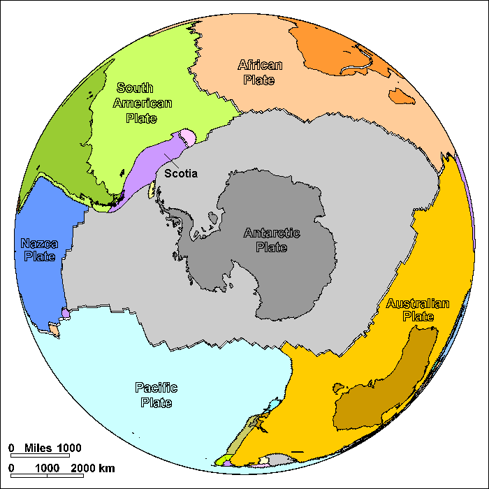
The Antarctic Sea Floor (Plate Boundaries Shown)
Steven Dutch, Professor Emeritus, Natural and Applied Sciences, University of Wisconsin - Green Bay
On these diagrams, plate boundaries are shown as simple solid lines. In many places, like convergent plate boundaries, they coincide with elevation contours.
The ocean floors show a remarkable degree of regularity. The crest of the mid-ocean ridges is at an average depth of 2700 meters, and the 3000 meter contour on the map reveals most of the crest. As newly formed ocean crust cools, it becomes denser and sinks, until it finally sinks to an average depth of 5500 meters. The broad deep areas about 5000-6000 meters below sea level are called abyssal plains and are the flattest areas on Earth. The very deepest parts of the ocean, up to 11 kilometers deep, make up a very tiny part of the sea floor. They are not out in the middle, like one might expect in a bowl. Instead they are long, narrow trenches close to a continent or island chain. The trenches mark convergent plate boundaries where oceanic crust sinks back into the earth's interior.
Antarctica was part of eastern Gondwanaland along with Madagascar, India and Australia. Eastern Gondwanaland broke off of Africa about 120 million years ago, and not long afterward, India and Madagascar broke off. Finally, Australia and New Zealand broke off around 50 million years ago. As a result, Antarctica is almost entirely surrounded by divergent plate boundaries.
As North America, South America, and Antarctica spread away from Africa, they also pulled away from each other. The gaps were filled by oceanic crust that now forms the tongue-like Caribbean and Scotia Plates.

Possible Coloring

Labeled Features
In addition to the large plates, significant small plates are labeled. Very small plates are not labeled.

Return to Geology Coloring Book Index
Return to Professor Dutch's Home Page
Created 10 August 2009, Last Update 15 January 2020