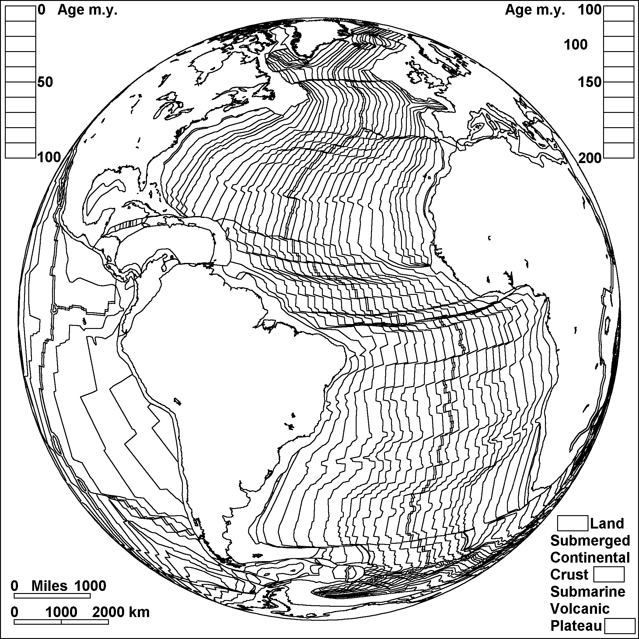
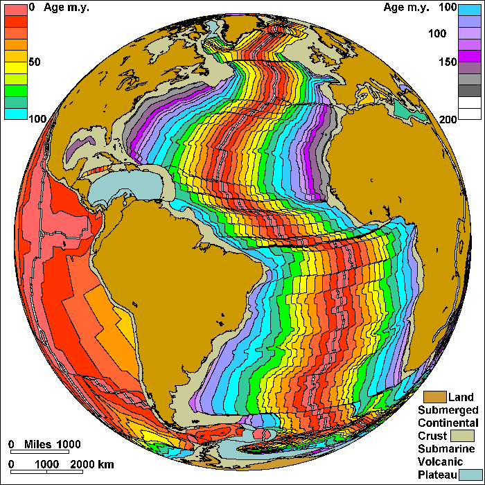
Sea Floor Spreading In the Atlantic (Plate Boundaries Shown)
Steven Dutch, Professor Emeritus, Natural and Applied Sciences, University of Wisconsin - Green Bay
Plates grow by pulling apart at the mid-ocean ridges and sinking back into the earth's interior at the tranches, mostly around the rim of the Pacific. As plates grow, they create strips of progressively older crust on either side of the ridge. We can determine the age of the ocean floor by drilling into it an retrieving samples, but mostly because newly formed crust is slightly magnetized by the earth's magnetic field, and we can compare the magnetism of the sea floor with the history of changes in the earth's magnetic field.
On these diagrams, pairs of parallel lines show boundaries where plates are spreading apart, and simple lines show other types of boundary. These include places where plates are simply sliding past one another, places where motions are too complex to portray simply, and places where new plate boundaries may be forming.
On the colored diagrams, land is brown, and submerged continental crust is tan. The bluish gray area, labeled Submarine Volcanic Plateau, includes large areas of sea floor where thick accumulations of lava flows built up. This color also indicates areas where the exact age of the sea floor is uncertain.
The earth has two kinds of crust. The continents are mostly made of thick granite. When continents pull apart, the gap is filled by thin crust made of basalt. In plate tectonics, a continent is any piece of continental crust surrounded by oceanic crust or plate boundaries. Greenland is a continent. It originally separated from North America, then broke apart from the Eurasian Plate to become a separate plate, but it is now attached to the North American Plate.
Possible Coloring
Return to Geology Coloring Book Index
Return to Professor Dutch's Home Page
Created 25 July 2009, Last Update 15 January 2020