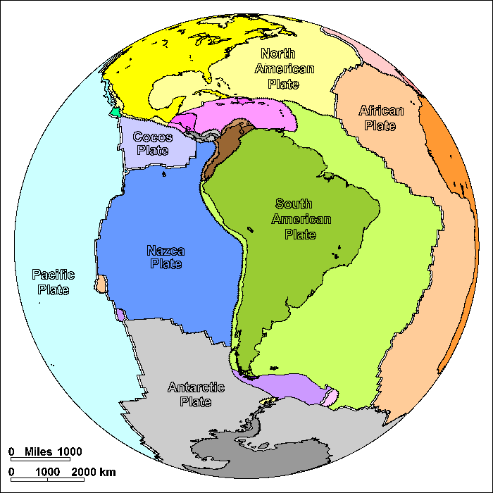
South American Plate
Steven Dutch, Professor Emeritus, Natural and Applied Sciences, University of Wisconsin - Green Bay
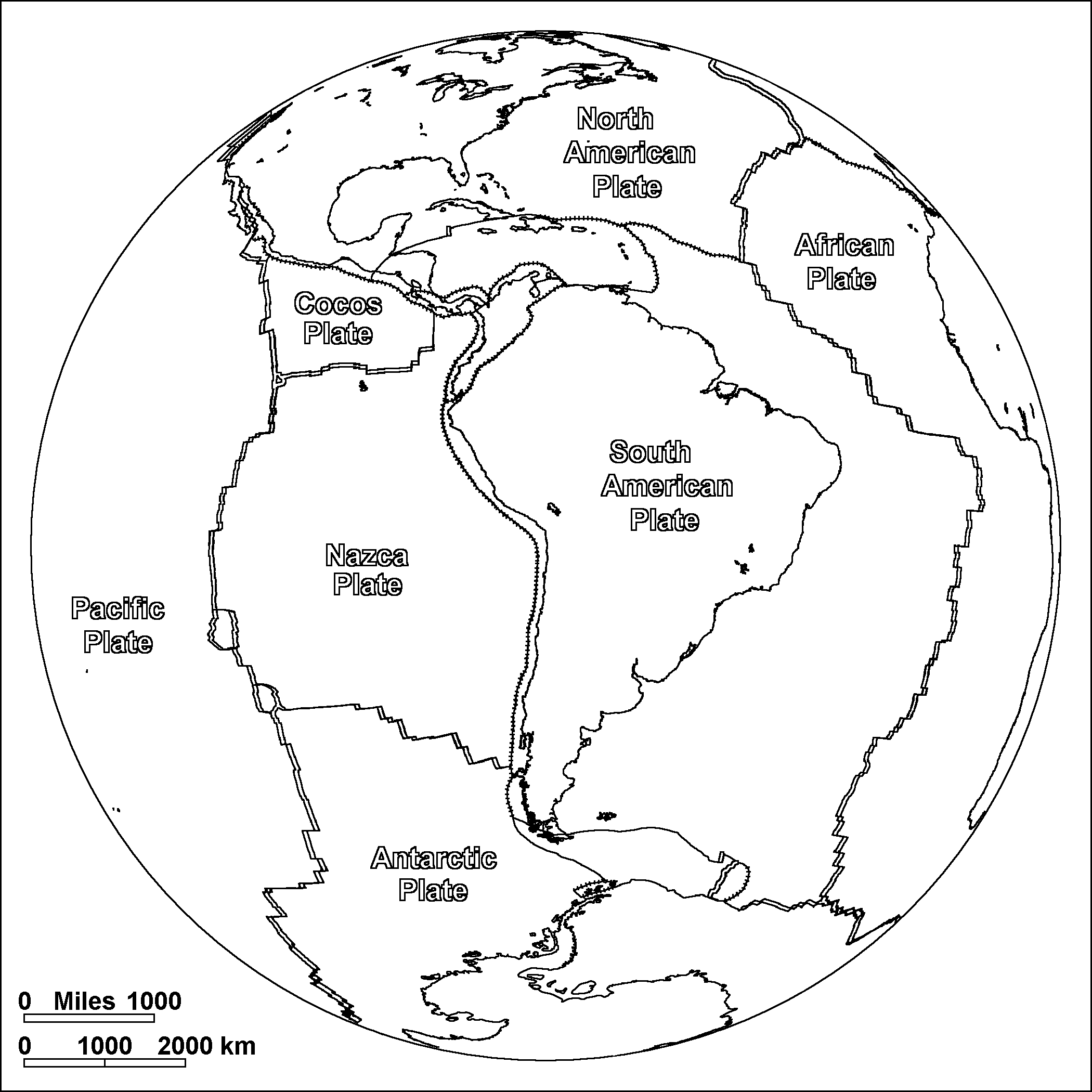
On these diagrams, pairs of parallel lines show boundaries where plates are spreading apart, lines with ticks show boundaries where plates are colliding, and simple lines show other types of boundary. These include places where plates are simply sliding past one another, places where motions are too complex to portray simply, and places where new plate boundaries may be forming.
It was the neat fit of the coastlines of South America and Africa that first led to suspicions they had once been joined. South America is moving westward away from the Mid-Atlantic Ridge. As North America, South America, and Antarctica spread away from Africa, they also pulled away from each other. The gaps were filled by oceanic crust that now forms the tongue-like Caribbean and Scotia Plates.
Oceanic crust is being subducted along the western coast of South America, creating the Andes. Most mountains along this sort of continental margin are 5000 meters high or less. The Andes rise to over 7000 meters. One theory is that the arid climate on the west coast of South America means little erosion and little sediment in the oceanic trench offshore. Since the sediment acts as a lubricant, the unusual height of the Andes may be the result of greater friction between the converging plates.
Possible Coloring
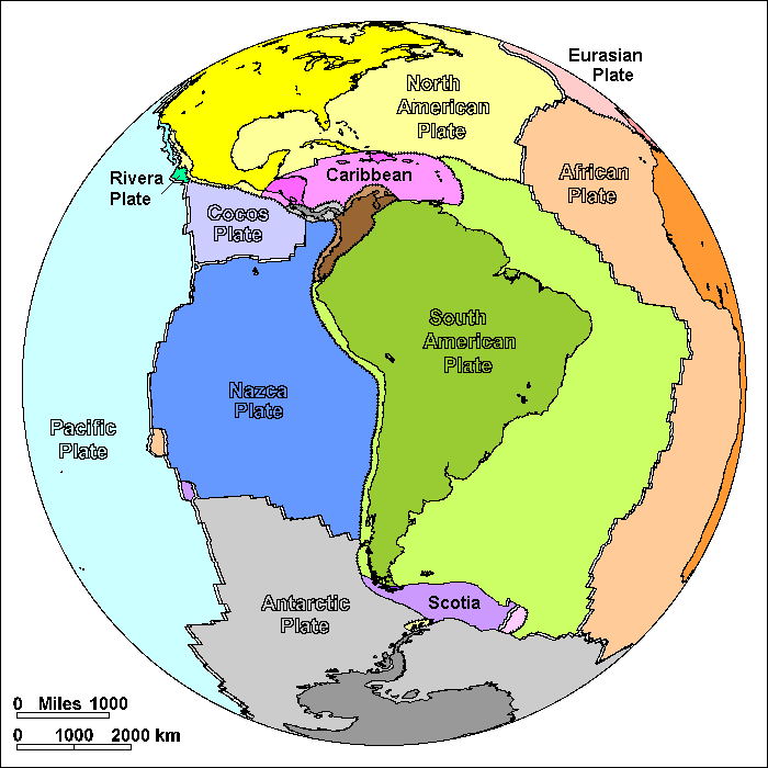
Labeled Features
In addition to the large plates, significant small plates are labeled. Very small plates are not labeled.
Return to Geology Coloring Book Index
Return to Professor Dutch's Home Page
Created 25 July 2009, Last Update 15 January 2020