High Falls Dam and Reservoir
Steven Dutch, Professor Emeritus, Natural and Applied Sciences, University of Wisconsin - Green Bay
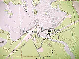 |
NW 1/4, Sec. 1, T32N R 18 E |
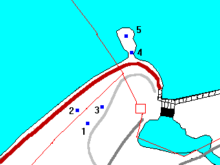 |
Legend
- Dark Gray: Paved Roads
- Light Gray: Dirt Road
- Red: Power Lines
- Brown: Dike
- Blue: Geologic Localities
- 1. Hagar "Rhyolite"
- 2. Crescentic Gouges
- 3. Whaleback
- 4. Chatter Marks
- 5. The Point
|
This locality provides an opportunity to view a variety of crystalline rock types as well as a number of different glacial ice direction indicators.
High Falls "Rhyolite"
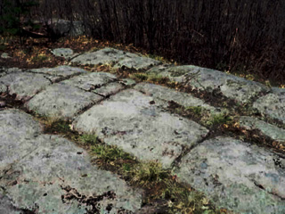 |
This rock, the High Falls "Rhyolite", actually seems to be an unusual fine-grained intrusive rock. This rock is at the extreme northern end of the Wolf River Batholith. Note the rectangular joints and the beginnings of spheroidal weathering. |
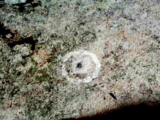 |
This circle once identifed a bench mark so mappers would be able to locate it on air photos. Unfortunately, souvenir-hunters like to take bench marks, despite the hefty fine for doing so. The remnants of the bench mark are still visible in the hole in the center of the circle. |
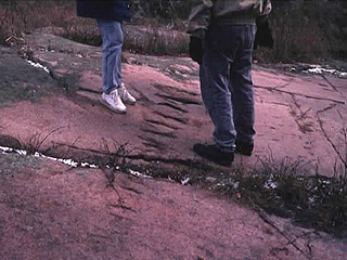
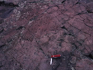
Crescentic Gouges
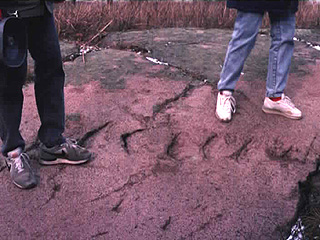 |
This train of fractures, called crescentic gouges, formed when the glacier pressed a boulder into the bedrock surface with enough force to fracture it. |
 |
An end-on view of the crescentic gouges. |
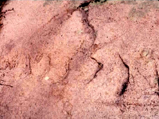 |
The rule with crescentic gouges is that the bow of the crescent points in the direction of ice movement (i.e. to the right). Here, surprisingly, that direction is northwest |
The Whaleback
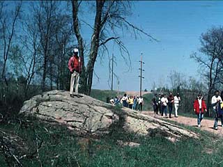 |
This sort of feature is called by a variety of names, including whaleback. When ice flows over a jointed outcrop, it presses the joints shut on the upstream side and smooths the rock off, producing a streamlined shape. On the downstream side, it pulls the joints open and plucks blocks away, creating an irregular, blocky face. |
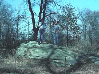 |
This feature also indicates an ice movement direction toward the northwest. Other terms for this feature include roche moutonee (French: sheep rock) or stoss-lee feature. The stoss side (German stossen to push) is the upstream side, and the lee side, of course, is the downstream side. |
The Point
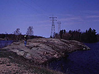 |
The point in the reservoir at the end of the access road has a number of interesting bedrock and surface features. |
 |
Compare the dark color of this rock to the pink rock at the first outcrop. The magma on the margins of the Wolf River Batholith reacted with the surrounding rocks and became more ferromagnesian in composition. The rounded grooves have joints running along them and are probably due to chemical weathering. Parts of the rock surface have glacial polish but polish extends into recesses as well. It's unlikely that ice could polish rock in small openings, but wind abrasion is a likely possibility. As the ice retreated, there would have been little vegetation, strong winds off the ice, and lots of sand and silt to blow around, a perfect setting for wind abrasion. |
 |
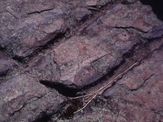
On this glacially-smoothed surface there are crescent-shaped fractures called chatter marks. Chatter marks seem to result from intense friction and can be made artificially by using too-high pressure when polishing lenses. Unlike crescentic gouges, these have the horns of the crescents pointing in the direction of ice movement. Again, it's to the northwest. Thus, there are three different ice-flow indicators in a small area, all indicating ice flow in an unexpected direction: to the northwest. |
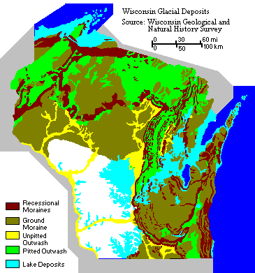 |
On this map, High Falls Dam is just northwest of the extreme northern tip of the glacial lake deposits. As we can see from the moraines along the western side of the Green Bay Lobe, it is not at all odd that the ice moved northwest in this region. The ice flowed down the axis of the lobe and spread out laterally, more or less perpendicular to the moraines. Since there was little or no ice to the west, the ice was free to flow northwest. |
Return to Geology of Wisconsin Index
Return to Geologic Localities Index
Return to Professor Dutch's Home Page
Created 19 May 1999, Last Update 19 May 1999