Glacial Lake Oconto (Williams' Farm)
Steven Dutch, Professor Emeritus, Natural and Applied Sciences, University of Wisconsin - Green Bay
 |
 |
 |
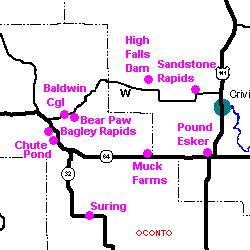
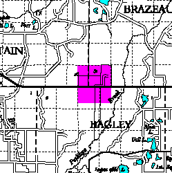
SE 1/4 Sec. 36 T31N R17E and SW 1/4 Sec. 31 T31N R18E
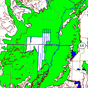
The large open area on the map is former wetland that has been drained for farming. |
Advancing lobes of glacial ice not only excavated the land but also disrupted drainage patterns. In some cases, ice blocked rivers and streams causing water to flood vast areas and creating large lakes. Later, when the glacial ice melted and drainageways were restored, lake levels dropped and in some cases lakes completely dried up. This stop reveals the remains of the northernmost margin of a large glacial lake that extended southward into the Stevens Point area.
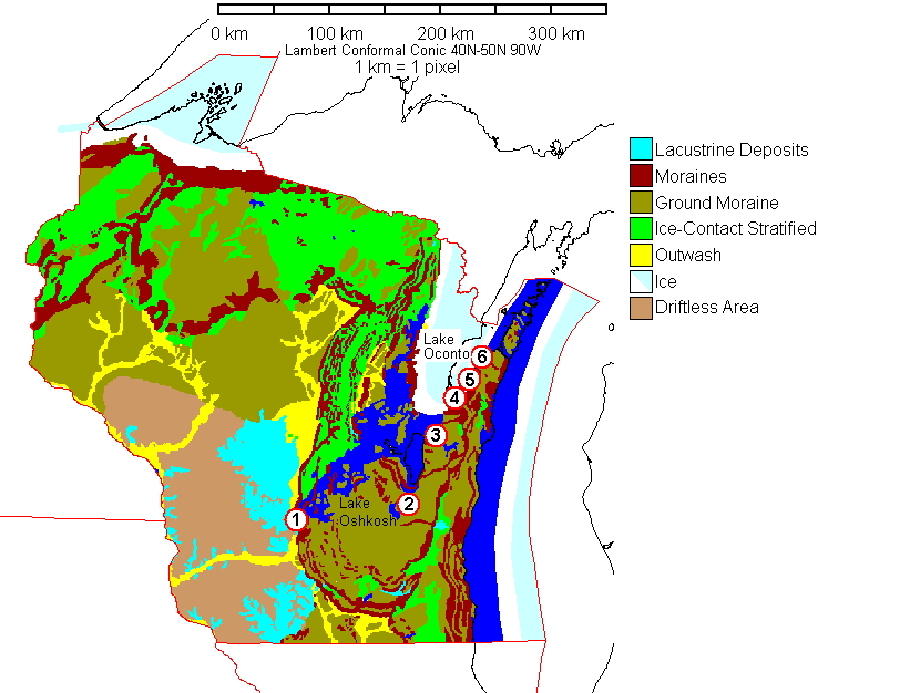 |
This map shows the ice partially retreated from Wisconsin, perhaps 12,000 years ago. Green Bay is still blocked by ice, so water flooded the Fox River Basin to form a large lake, Glacial Lake Oshkosh. Water also backed up northward behind the moraines to form a northern arm, Glacial Lake Oconto. As ice retreated up the Green Bay Lowland, it uncovered successively lower outlets for Lake Oshkosh (1-6 in red). |
Glacial Lake Oconto must have been blocked by ice to the east, since there are many possible outlets in that direction today, and modelling of glacio-isostasy indicates that it was probably fairly deep. Also, as the ice retreated, each new outlet lowered the level of Glacial Lake Oshkosh, and it is unlikely that the entire area covered by lake deposits was ever a lake at any one time. Glacial Lake Oconto would have drained early in the retreat of the ice. Thus the present peat soils cannot date from the time of the glacial lake; the glacial lake deposits are the flat-lying sands beneath. The organic soils are probably quite recent, forming after the lake itself drained but while the former glacial lake plain was a poorly-drained wetland.
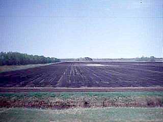 |
The soil here is rich in organic matter but quite thin. Note the sandy spot where plowing has exposed the underlying lake sands. This soil at this site has become noticeably lighter and thinner since I first saw it in 1976. |
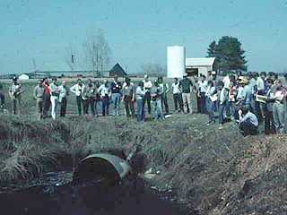 |
Drainage ditches like this lower the water table, making it possible to farm what would otherwise be marshy ground. Whether this would be allowed to happen today with regulations governing wetlands is not certain. |
Return to Geology of Wisconsin Index
Return to Geologic Localities Index
Return to Professor Dutch's Home Page
Created 19 May 1999, Last Update 21 June 1999