Wyalusing
Steven Dutch, Professor Emeritus, Natural and Applied Sciences, University of Wisconsin - Green Bay
Sec. 17, T6N R6W, Grant County 4 miles south of Prairie du Chien.
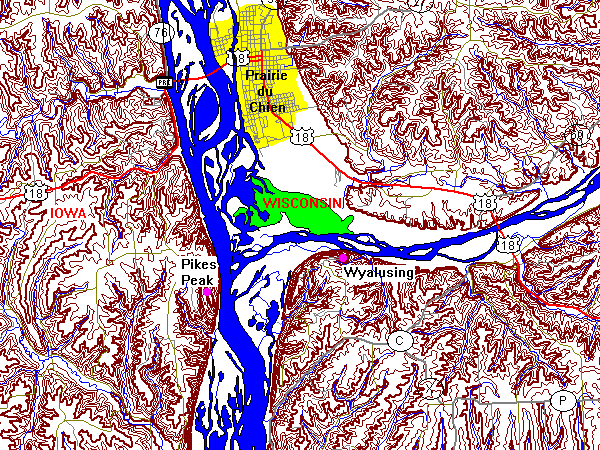
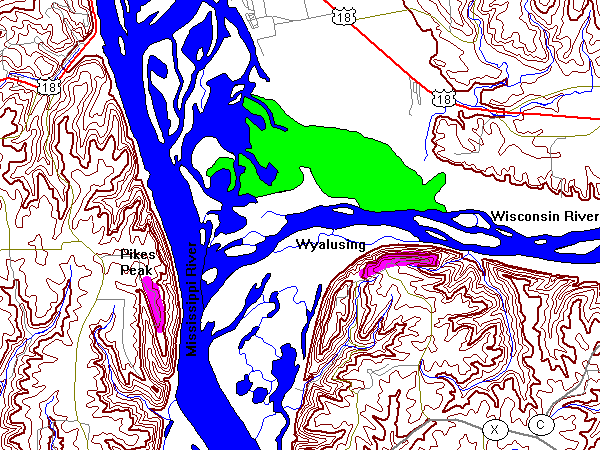
Spectacular bluffs of Prairie du Chien dolomite overlook the confluence of the Wisconsin and Mississippi Rivers. Both rivers are conspicuously underfit with deep gorges, truncated spurs and flat floors, testifying to intense erosion during the Pleistocene by glacial meltwaters.
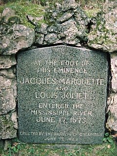 |
At the foot of this eminence Jacques Marquette and Louis Joliet entered the Mississippi River June 17, 1673. |
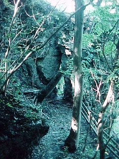 |
Outcrops of Prairie du Chien dolomite below the bluffs. For those with less academic tastes, Wyalusing is reputedly the hiding place for a gold payroll stolen from Fort Crawford (Prairie du Chien) in the early 1800's. |
The Wisconsin River Valley
Below is a panoramic view spanning from nearly due west at left to northeast at right. The confluence of the Mississippi and Wisconsin Rivers is at far left, with the Wisconsin River dominating the foreground across the entire scene. The Mississippi River is at the base of the distant bluffs on the left, with Iowa on the other side. The highest hill at far left is Pike's Peak, where there is a spectacular view of the confluence from the Iowa side.
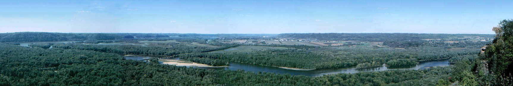
If the Mississippi is an underfit stream, you can just imagine the water this valley carried during the Pleistocene. The valley was probably cut by floods originating out of Glacial Lake Aggasiz as it repeatedly broke its ice dams. The floods spilled into Lake Superior, then down the St. Croix valley (itself the site of some spectacular megaflood evidence), then down the Mississippi. The Wisconsin River carried the floodwaters from the sudden release of Glacial Lake Wisconsin.
Looking East
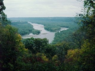 |
A view up the Wisconsin River. |
Return to Geology of Wisconsin Index
Return to Geologic Localities Index
Return to Professor Dutch's Home Page
Created 22 September 2000, Last Update 11 January 2020