United States 40N 100W
Steven Dutch, Professor Emeritus, Natural and Applied Sciences, Universityof Wisconsin - Green Bay
Scale: 1 pixel = 10 km. 10-degree grid; Lambert Conformal Conic Projection, Center 40N 100W
Legend
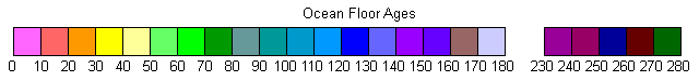
Ocean Floor Ages
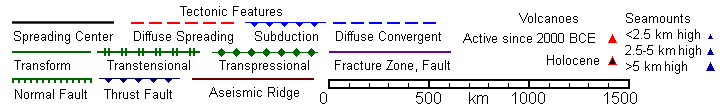
Tectonic Structures
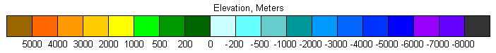
Topography
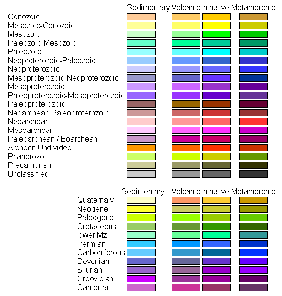
Land Geology
Discussion
The eastern margin of the North American Plate is the type passive or trailing continental margin. Much of the western United States is Paleozoic and Mesozoic accreted terranes. The former subduction zone ceased to exist when North America came into direct contact with the Pacific Plate about 30 million years ago, and the boundary became a transform, now consisting of the San Andreas Fault and the transtensional Gulf of California.
The former subduction zone still exists along the west coast of Mexico and Central America, and along the coast of Oregon and Washington. Curiously, this subduction zone lacks a trench, because of a unique circumstance. It is the only subduction zone with a major river, the Columbia, emptying into it. Instead of building a delta, the Columbia fills in the trench. In addition, the vast Pleistocene Missoula Floods dumped stupendous quantities of sediment into the trench as well.
Nevada and much of Utah are a closed drainage basic created by extensive normal faulting that created the Basin and Range Province. The structure and lithology of this province cannot be shown effectively at this scale and the lithology is generalized as Quaternary basin fill or horst-capping volcanic rocks.
Return to Global Geology Index.htm
Return to Professor Dutch's Home Page
Created 11 April 2014, Last Update 19 January 2020