History of Global Plate Motions
Steven Dutch, Professor Emeritus, Natural and Applied Sciences, University of Wisconsin - Green Bay
Display Options
You can simply scroll down through the maps, reading the text for each. You can also flip from map to map by clicking on the Later and Earlier prompts. To view a map of an earlier time, select "Earlier", to view a map of a later time, select "Later."
There is a similar set of maps using 1994 data. It's revealing to compare the two to see how our understanding of plate configurations has changed with 15 years of better data. In general, the later maps include a lot more small terranes, a great deal more accurate information about the assembly of Asia, and extend further back in time to the late Precambrian. By 1994 it was possible to understand at least roughly the assembly of the plates that formed Gondwanaland, something not possible in this set.

Earlier
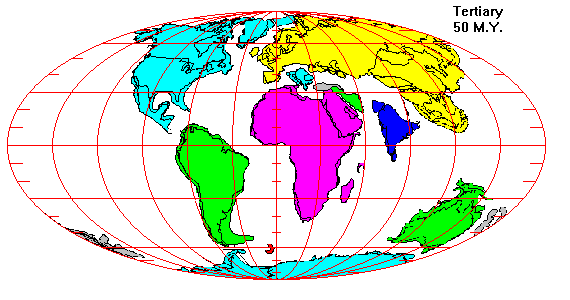
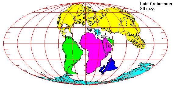
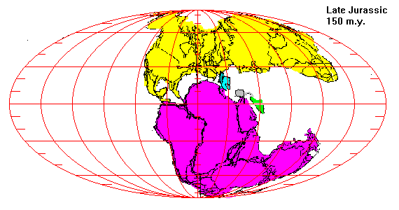
Breakup of Pangaea
Later=======Earlier
Later=======Earlier
Later=======Earlier
Later=======Earlier
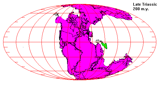
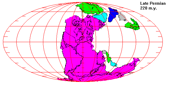
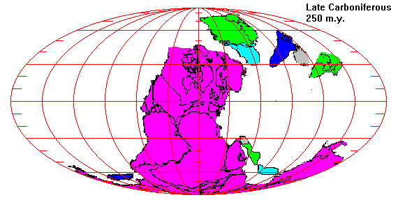
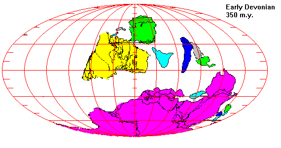
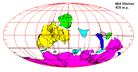
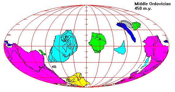
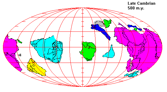
Assembly of Pangaea
Later=======Earlier
Later=======Earlier
Later=======Earlier
Later=======Earlier
Later=======Earlier
Later=======Earlier
References
Return to Plate Tectonics Page
Return to Physical Geology Class Notes Index
Access Crustal Movements Notes Index
Return to Professor Dutch's Home Page
Created 22 December 1998, Last Update 19 January 1999