Seismic Tomography
Steven Dutch, Professor Emeritus, Natural and Applied Sciences, University of Wisconsin - Green Bay
Most people know someone who's had a "CAT Scan." That doesn't mean looking around to see if you let the cat out. CAT stands for Computer Assisted Tomography. You can send signals through an object in different directions and add the signals to construct a cross section of the object. If the object is a human body, doing it with X-rays is a good deal less drastic than doing it with a scalpel. Other radiation can be used as well; PET scans use positron emission. In the earth, we can apply the method using seismic waves.
Example 1: Finding Missouri
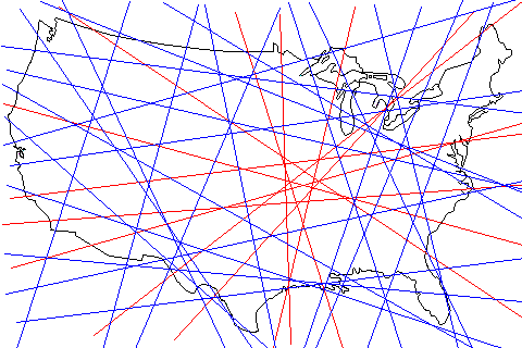 |
Imagine you had no way of finding out where Missouri was except by plotting the paths of satellites and knowing they had either passed over Missouri (red) or not passed over it (blue).
The concentration of red in the right center suggests the location of Missouri. |
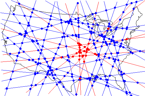 |
We can achieve a bit more precision by noting that all blue lines pass outside Missouri and therefore all intersections with a blue line must lie outside Missouri. These are shown with blue dots.
Only intersections between two red lines can be within Missouri (red dots). Note that some lie very far from the main cluster. We suspect these are artifacts because all the other nearby dots are blue. (But what if the area we were trying to locate really had tiny outlying pieces?) |
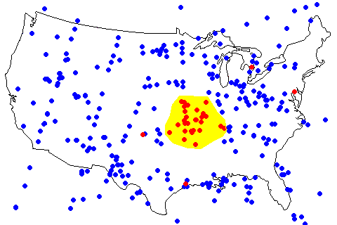 |
The main cluster is outlined here in yellow. |
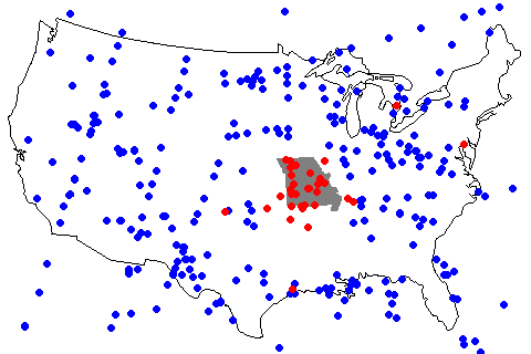 |
This map shows the actual location of Missouri in gray. We could have gotten a more precise estimate with more closely-spaced lines. |
Example 2: Finding Texas
Here's an example that is actually a little closer to the way seismic tomography is actually done.
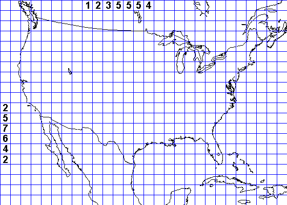 |
Here we've put a grid over the United States. Imagine we send signals along the grid rows and count the number of squares where we find Texas. |
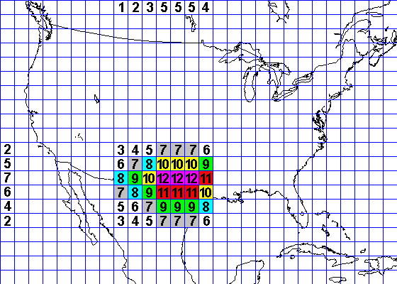 |
We go back through the grid and sum the vertical and horizontal signals. The highest values are the most likely location. |
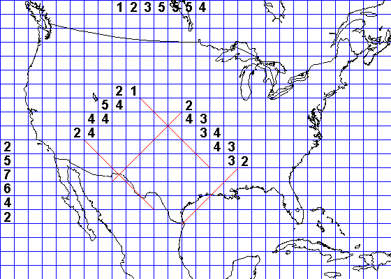 |
We can also count squares in diagonal directions as well. |
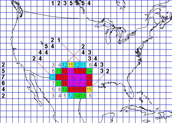 |
Here we sum up the signals in all four directions. We get a sharper fix on location and also a more precise idea of the shape. A finer grid would have improved the resolution. |
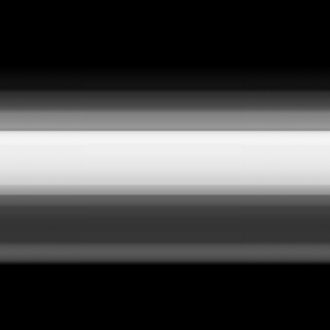
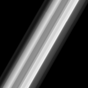
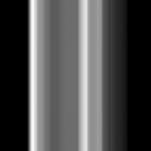
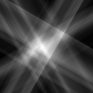
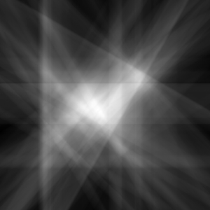
Here's a bit more ambitious example. We'll try to reconstruct a moderately complex image. Instead of summing numbers in rows, we'll smear the image in different directions. The brightness represents the strength of the signal. For example, in the first image, we know there's a large amount of image along the bright band, but we don't know where. It's somewhere along that band. The other scans will help identify exactly where.
 |
 |
 |
 |
 |
 |
 |
 |
We can also identify the directions with zero value. We know that no place along these directions can include any part of the image. This won't work if the pattern we're trying to reconstruct has positive and negative values, but this is a simple approximation.
 |
 |
 |
 |
 |
 |
 |
 |
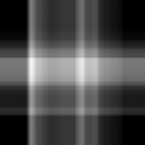
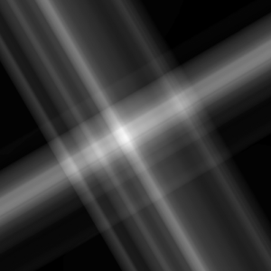
Now we sum up the scans in pairs. First we'll sum 0 and 90 degrees, 30 + 120, 45 + 135, and 60 + 150.
 |
 |
 |
 |
Next we sum those sums. We'll sum 0+45+90+135 and 30+60+120+150
 |
 |
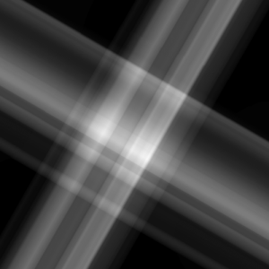
Finally we sum those images to get a final result, and mask off the areas where we know there is no image.
 |
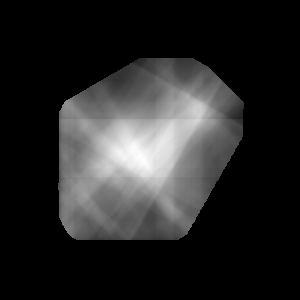 |
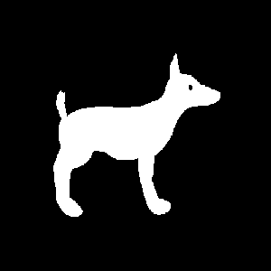
| We can see there's a central mass with a smaller mass to the upper right, a short projection to the upper left, and projections below with a vacant space in between. The actual scanned image is at right.
This is a crude analogy but it manages to capture the main elements of the shape. |
 |
Return to Earth Science 202 Class Notes Index
Return to Professor Dutch's Home Page
Access Crustal Movements Notes Index
Created 18 Nov 1997, Last Update 15 January 2020