Geology and Election 2000
Steven Dutch, Professor Emeritus, Natural and Applied Sciences,Universityof Wisconsin - Green Bay
Presidential Election Returns
Note on Coloring
It's conventional among the media these days to use blue for Democratic and red for Republican. The maps here mostly use blue for Republican, yellow and orange for Democratic. The present red-blue coloring scheme runs counter to most historical American usage plus the custom in most other democracies, where red is used for left-leaning parties and blue for right-leaning.
The present media usage dates only from 2000, and I have a suspicion it was driven partly by a desire to neutralize the negative connotations associated with "red" in American politics. Europeans, used to seeing socialists and communists on the ballot as serious contenders, don't share that association.
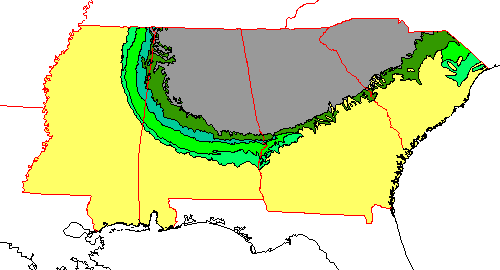 | At left for reference is a simplified geologic map of the Deep South, with Cretaceous units in green. |
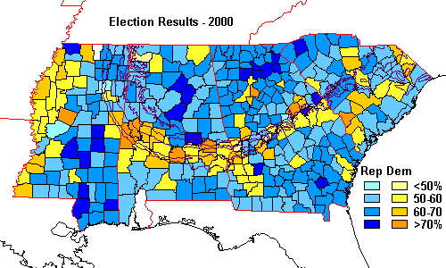 | For reference, the 2000 election returns are at left. Note the heavy preponderance of Democratic counties along the Cretaceous outcrop band from Mississippi through Georgia. |
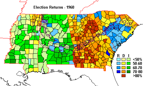 | In the 1960 election, Democratic Electoral College votes in Alabama and Mississippi went to Harry Byrd rather than John F. Kennedy. The band is not visible. |
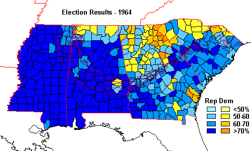 | In the highly partisan election of 1964 the arc is not visible at all. This is the election that marked the end of the old Democratic South and the start of the modern Republican southern vote. Republican Barry Goldwater opposed the Civil Rights Act of 1964, a stance that won approval in the South. |
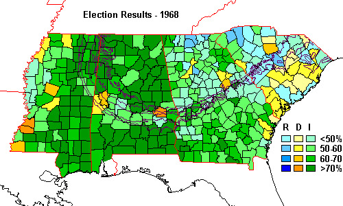 | In 1968, much of the South went for George Wallace, running as an independent. The arc shows up plainly in Alabama as a band of low support for Wallace, and can be seen in somewhat less obvious form in Georgia and Mississippi as well. For the first time, the band is visible, because the Voting Rights Act made it possible for many black voters to vote for the first time. |
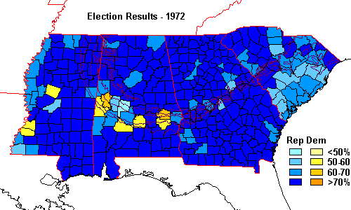 | In the highly partisan election of 1972, the Alabama portion of the arc stands out as one of the few Democratic areas. This election was a Republican landslide. |
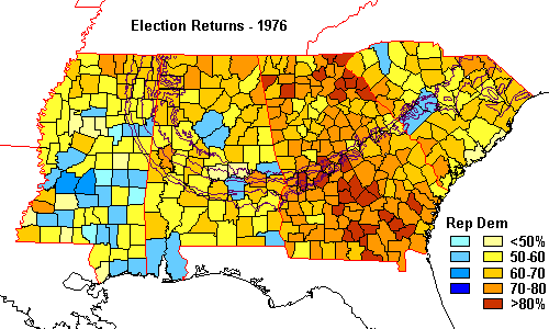 | In 1976, Georgia governor Jimmy Carter took the South and the band was swallowed up by the overall Democratic sweep. Note the landslide in Georgia, Carter's home state. |
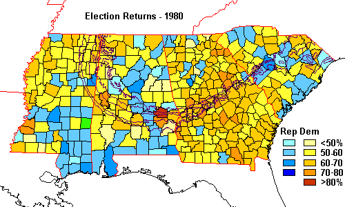 | In 1980, Jimmy Carter lost to Ronald Reagan but was still popular enough to carry much of the South. The band mostly disappears in the general Democratic vote. |
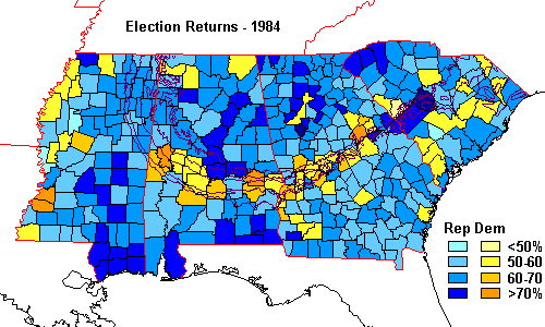 | In 1984, the Alabama-Georgia portion of the arc is very clear. |
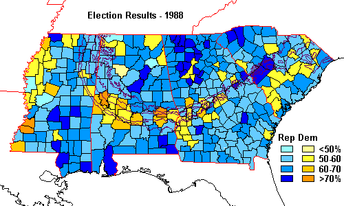 | In 1988, the results are a near duplicate of 1984. |
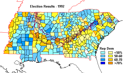 | In 1992, southerner Bill Clinton defeats George Bush. The arc shows up plainly. |
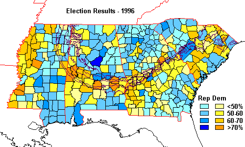 | 1996 results closely duplicate those of 1992, but are more partisan. |
| For comparison, the 2000 returns are repeated. |
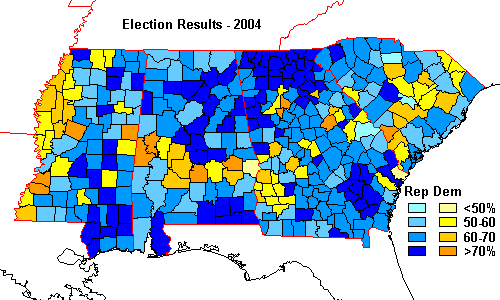 | The pattern continues in 2004, with Republican areas more so than in 2000. |
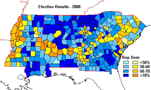 | The pattern continues in 2008. In both 2004 and 2008, the Republican areas are more strongly republican than any other elections. |
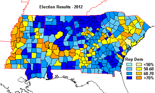 | You have to look pretty hard to see differences between 2008 and 2012. |
 | |
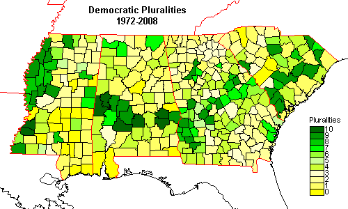 | Democratic and Republican pluralities, 1972-2008. The gap in Alabama in an otherwise Democratic band is Montgomery County, home of the state capitol, much more urbanized, racially mixed and wealthy than the rest of the band. |
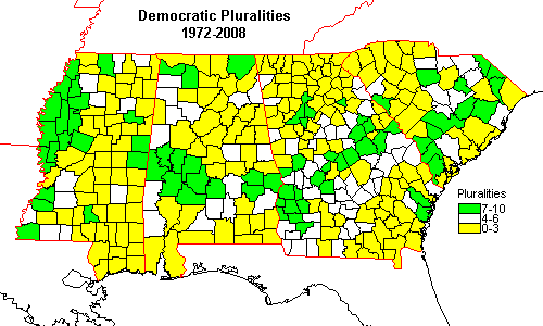 | Map of Democratic and Republican pluralities, 1972-2008, showing the strongest party preferences. Although some sites claim the real electoral map of the U.S. is "purple" (a near even mix of Democratic and Republican, this map is pretty much red and blue (or yellow and green in this case), with some areas consistently Democratic, others consistently Republican, and not much in between. |
Return to Overview
Geology and Election 2000: Election Returns
Geology and Election 2000: History
Geology and Election 2000: Economics and Land Use
Geology and Election 2000: Demographics
Geology and Election 2000: Conclusions
Return to Professor Dutch's Home Page
Created 23 January 2002, Last Update 24 May 2020