Gravity and Magnetic Maps of the United States
And Adjacent Canada
Steven Dutch, Professor Emeritus, Natural and Applied Sciences, Universityof Wisconsin - Green Bay
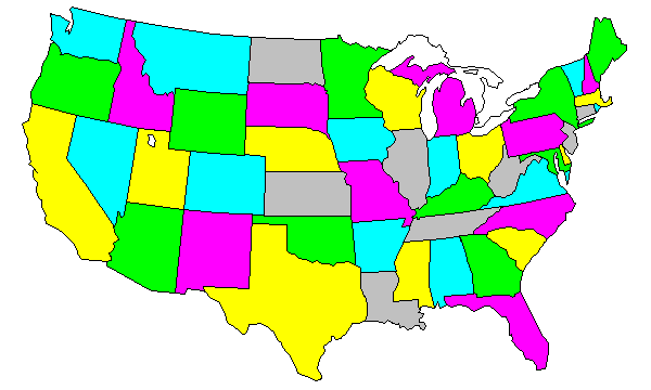
Index Map
Click on the desired state to view the map. Scale on all maps is one pixel =one kilometer
Canada
Gravity and Magnetic Map of
Southern Ontario
Gravity and
Magnetic Map of East-Central Ontario (north of Lake Huron)
Gravity and Magnetic Map of West-Central
Ontario (north of Lake Superior)
Gravity and Magnetic Map of Ontario:
James Bay
Gravity and Magnetic
Map of Northwest Ontario
Gravity and Magnetic Map
of Maritime Provinces
Gravity
and Magnetic Map of Newfoundland
Geologic and Bouguer Gravity Map
of the Grand Banks and Flemish Cap
About the Maps
The maps were generated from U.S. Geological Survey and Canadian Digital Data using Global Mapper 14.
References
Principal sources for data. Links, even those of government agencies, go out of date quickly and are mostly not provided. Search by title and publication number to find links to data.
- Conterminous US Geology
- US Geological Survey: Mineral Resources; Geology of the conterminous United States. A digital version of the Geologic Map of the United States, originally published at a scale of 1:2,500,000 (King and Beikman, 1974b). Excludes Alaska and Hawaii.
- Detailed Geology of States
- US Geological Survey: Mineral Resources: Online Spatial Data; Geologic maps of US states
- US Bouguer Gravity
- US Geological Survey: Mineral Resources; Online Spatial Data; Gravity anomaly grids for the conterminous US
- US Isostatic Gravity
- US Geological Survey: Mineral Resources; Online Spatial Data; Gravity anomaly grids for the conterminous US
- US Magnetic Anomalies
-
- US Geological Survey: Digital data grids for the magnetic anomaly map of North America: Open-File Report 02-414
- Digital Aeromagnetic Datasets for the Conterminous United States and Hawaii - A Companion to the North American Magnetic Anomaly Map, U.S. Geological Survey Open-File Report 02-361
- Digitized Aeromagnetic Datasets for the Conterminous United States, Hawaii, and Puerto Rico, U.S. Geological Survey Open-File Report 99-0557
- Canada Geology
- Wheeler, J.O., Hoffman, P.F., Card, K.D., Davidson, A., Sanford, B.V., Okulitch, A.V., and Roest, W.R. (comp.) 1997: Geological Map of Canada, Geological Survey of Canada, Map D1860A.
- Canada Bouguer Gravity and Magnetic
- Natural Resources Canada; Earth Sciences Sector; Geoscience Data Repository
- Magnetic Anomalies outside US
- US Geological Survey: Digital data grids for the magnetic anomaly map of North America: Open-File Report 02-414
- Offshore Geology
- Mostly from US Geological Survey; Resources for the Geologic Map of North America; GIS Files (shapefiles); (ESRI geodatabase only is USGS DR-424)
- Western Mexico Geology
- US Geological Survey; Resources for the Geologic Map of North America; GIS Files (shapefiles); (ESRI geodatabase only is USGS DR-424)
- Eastern Mexico and Gulf of Mexico Geology
- US Geological Survey OFR 97-470-L; Map Showing Geology, Oil and Gas Fields, and Geologic Provinces of the Gulf of Mexico Region; Digitally Compiled by Christopher D. French and Christopher J. Schenk
- Caribbean Geology
-
- US Geological Survey OFR 97-470-K; Map Showing Geology, Oil and Gas Fields, and Geologic Provinces of the Caribbean Region; Digitally Compiled by Christopher D. French and Christopher J. Schenk
- Hearn, P., Jr., Hare, T., Schruben, P., Sherrill, D., LaMar, C., and Tsushima, P., 2001, Global GIS Database, Digital Atlas of Central and South America: U.S. Geological Survey Digital Data Series DDS-62-A. [on-line] available at: http://webgis.wr.usgs.gov/globalgis/
- U.S. Geological Survey World Energy Assessment Team, 2000, U.S. Geological Survey World Petroleum Assessment 2000: U.S. Geological Survey Digital Data Series DDS-60, 4 CD-ROMs. [on-line] available at: http://pubs.usgs.gov/dds/dds-060
- Arctic Offshore and Greenland
- Maps showing Geology, Oil and Gas Fields, and Geologic Provinces of the Arctic; Compiled by Feliks M. Persits and Gregory F. Ulmishek; U.S. Geological Survey Open File Report 97-470-J
- Ocean Floor Isochrons
- Muller, R. D., M. Sdrolias, C. Gaina, and W. R. Roest (2008), Age, spreading rates, and spreading asymmetry of the world's ocean crust, Geochem. Geophys. Geosyst., 9, Q04006, doi:10.1029/2007GC001743. On-line through NOAA; Age, spreading rates and spreading symmetry of the world's ocean crust (Version 3, September 2008) Contoured using Global Mapper 14.
Access Steve Dutch's Home Page
Created 23 July 2001, Last Update 05 June 2020