Contouring Structural Data: Moving Circle Method
Steven Dutch, Professor Emeritus, Natural and Applied Sciences, University of Wisconsin - Green Bay
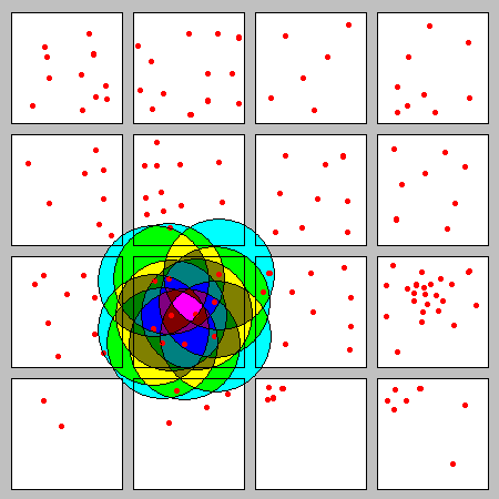 |
The red dots show the locations of people in a village. How can we characterize the population density from place to place?
The overlapping circle method is a good way to do it, but it can be laborious when there are a lot of data points, especially if there are areas of high density. |
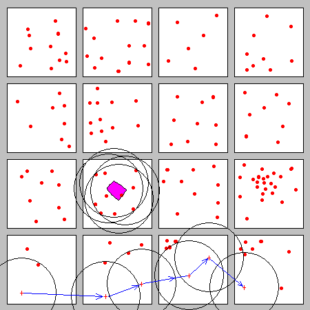 |
A faster, somewhat more approximate method is to slide a circle around so that it always contains exactly a certain number of points, and plot the location of the center.
At the bottom, for example, the circle is tracing out the outer limits of the one person per unit area density. The 10 person per unit area (purple) outlines the limits around which we can move the circle and always contain 10 people within it. The logic of this method is exactly the same as the overlapping circle method, and if we were to do this style of contouring with complete accuracy we would get the same result. |
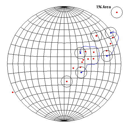 |
We contour structural data in the same way. Isolated points are at the centers of circles. Elsewhere, we trace the outer limits of one point per one percent area by moving a circle so it always contains just one point. We proceed similarly for two points per one percent area, three, and so on. |
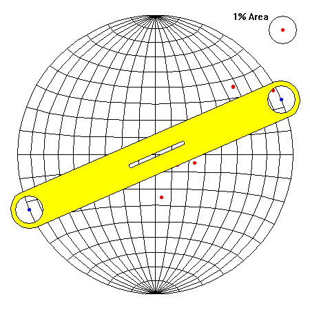 |
Contours that cross the primitive circle must re-enter on the opposite side. For simple data the connection can be made by eye, but for extensive contouring work it can be useful to create a template with circles at opposite ends. The distance between the centers of the circles is the diameter of the net. A short slot keeps the template aligned through the center of the net. |
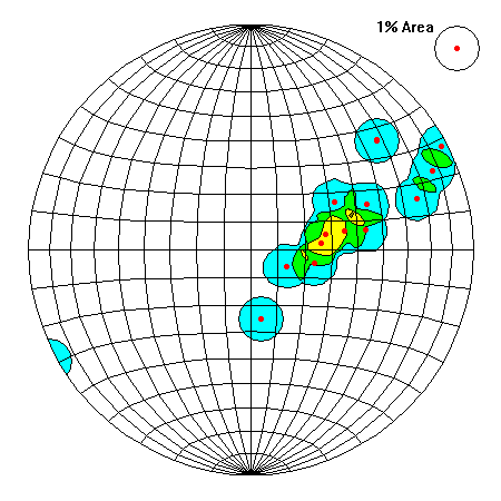 |
The final result might look like this, depending on how fastidious you are about following tiny variations in the data. |
Advantages
- Faster than the overlapping circle method
- Easier when data is very dense
Disadvantages
- Somewhat approximate. Everyone gets slightly different results
Return to Course Syllabus
Return to Techniques Manual Index
Return to Professor Dutch's Home Page
Created 16 June 2005, Last Update
12 June 2020