Nobody Gets Out of Here Without Learning Some Geology
Steven Dutch, Professor Emeritus, Natural and Applied Sciences, University of Wisconsin - Green Bay
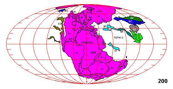
The story of the Mediterranean, the Middle East, and south Asia is the story of the breakup of Pangaea beginning about 180 million years ago. Between Eurasia and the southern continents was a wedge-shaped seaway that geologists have named the Tethys. As Pangaea broke apart, Eurasia rotated south and Africa and India rotated north, closing up the Tethys. The map shows the estimated arrangement of the continents just before the breakup, around 200 million years ago.
 |
Turkey, Greece, and Iran are small pieces of continental crust that are being crunched by the convergence of Africa and Eurasia. 20 million years ago the plates looked something like this. There were still remnants of the Tethys. Columbus wouldn't have needed to sail west to reach Asia, and there would have been no need for a Suez Canal.
Greece, Turkey, and Iran are drawn in their present shapes, but the reality is they are all mosaics of small pieces and nobody has a clear idea exactly what they looked like. They were probably originally attached to Africa, but the details are still unknown. |
Below, the present plate boundaries. Remnants of former oceanic crust are trapped in the Black Sea and the southern Caspian. These and the Mediterranean are the last remnants of the Tethys. This is not a highly volcanic region but volcanoes active in the last million years or so are shown as red triangles. The one at the extreme eastern end of Turkey is Mount Ararat. All the highest peaks in this region, including Ararat, Elbrus in Russia and Demavend in Iran, are volcanoes. Thera or Santorini, which erupted around 1650 B.C. and destroyed the Minoan civilization, is the volcano just north of Crete. The volcanoes have a variety of causes. Some are related to subduction zones; others to crustal extension. There are undoubtedly other volcanoes not yet catalogued.
On very small scales it can be hard to define plate boundaries exactly. The Anatolian Fault marks the plate boundary clearly for much of the length of Turkey but in western Turkey and Greece the plate boundaries are diffuse and poorly defined. The Balkans are made up of a number of small plates that are not shown separately here.

In the map below, major faults are shown in dark blue and major fault zones (most are plate boundaries) in green. Basically Turkey is being squeezed west, like a watermelon seed between your fingers, a process called tectonic extrusion. In western Turkey the crust is free to spread out over the descending African Plate and the crust breaks up into a series of fault basins (grabens, light blue) and uplifted blocks (horsts, gray). This sort of topography is typical of areas where the crust is being stretched and is a small scale version of the topography of the Great Basin in the U.S. A similar situation exists in Greece except the direction of crustal extension is very different. Note that many of the peninsulas and islands of Greece are upliifted fault blocks. The Sea of Marmara is a series of grabens.

Faults Near Istanbul
Below is a topographic map of the Istanbul region. Note that the Sea of Marmara is mostly shallow but gets very deep in the central part, which actually consists of a series of basins separated by ridges.

Below is a simplified fault map of the region. The Sea of Marmara was surveyed in great detail by Aksu and others (2000). The plate boundary is shown in dark blue. In the Sea of Marmara it fans outward near the surface because of the southward spreading of the crust. Two principal fault zones shown in red form the northern and southern boundaries of the deep basins, and a large number of faults break the intervening crust into narrow slivers. Some of the principal faults are shown in purple. Downdropped blocks of crust are in blue and uplifted blocks are in green.
Additional major faults south of the Sea of Marmara are also shown in red; they are simplified from Barka and Kadinsky-Cade (1988). The area north of the Sea of Marmara really does seem to be less faulted because it's on the Eurasian Plate.

 |
South coast of the Sea of Marmara near Bursa: a fault coastline. |
 |
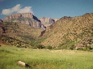
Looking east along the flank of Uludag. Uludag, some 2500 meters high, is the highest peak on the map above, about 100 kilometers due south of Istanbul. It is often visible from Istanbul on a clear day, especially if it's snow covered, as it often is. The steep mountain front is a major fault scarp. |
 |
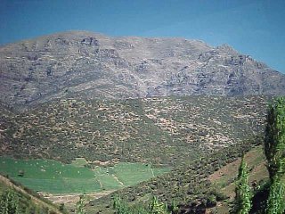
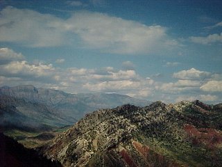
The mountains south of Erzerum, probably a fault scarp. The slope break in the alluvial fans at the base of the mountains is a strong indicator of recent faulting. |
 |
The mountains north of Erzerum. At right is what appears to be an obviously young volcanic cone, although it is not listed in any of the global volcano databases. And for good reason. Google Earth doesn't show any volcanoes near Erzerum - it's a sharp-edged ridge seen nearly end-on. |
 |
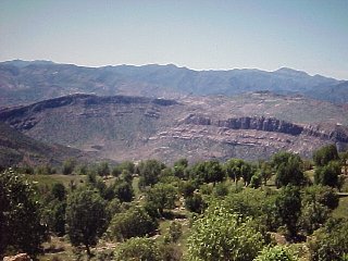
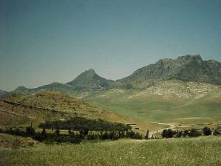
Near Kayseri. The high mountain in the background is the Erciyes Dagi, a large stratovolcano 13000' high or comparable to Mount Shasta. The name Kayseri comes from the old Roman name of the city 'Caesarea', or Caesar's city." |
 |
East of Izmit. The lake is Sapanca Lake. The North Anatolian Transform Fault runs along the axis of the lake. Just west of the lake the fault breaks up into the complex fault network of the Sea of Marmara. |
 |
Just east of Izmit. Looking across Sapanca Lake and the North Anatolian Transform Fault. |
 |
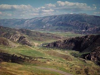
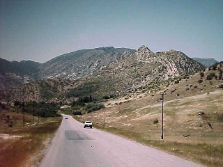
The mountains east of Adana in southeastern Turkey are truncated sharply on the east by faults that are an extension of the Dead Sea Transform system.
I got to see another part of Turkey in 1991 during the Kurdish relief efforts. |
 |
Looking back at the mountain front from a distance. |
 |
The next several pictures are from northern Iraq just south of the border with Turkey. They illustrate the collision tectonics on the northern edge of the Arabian Plate. It's classic foreland fold-and-thrust geology.
Looking south toward a large anticlinal ridge, the Chiya-e-Batin. The curvature of the layers is obvious. |
 |
Looking west along the anticline axis. Note the fault offset. |
 |
The northern flank of the anticline. Steep white sandstone hogbacks are underlain by soft red mudrocks. The bluffs in the distance are the edge of a large thrust sheet. |
 |
Looking at the bluffs. The thrust fault is between the foreground hills and the base of the bluffs. |
 |
View of the thrust fault, marked by the color contrast. |
 |
Here the thrust fault is marked in red. In the foreground hill, a north-dipping layer (yellow) bends upward abruptly to near vertical |
 |
Just south of the thrust fault. Distant layers visible above the road dip about 30 degrees southward (left); in the highest peak they are vertical and in the cliff on the right they are steeply overturned to the north (right). |
Where Did The Straits Come From?
Back in 1634, Jean Nicolet sailed into Green Bay, stepped ashore, and did two things:
- First, he asked the score in the Packer game (and I am not responsible for what happens if you cite that in an assignment!)
- Second, he put on Oriental robes in case he met any Chinese (this part is true).
We often wonder now how anybody could be naive enough to think he could sail up a river, into a lake, and come out on the other side of a continent.
 |
But take a look at the coastline of Europe, the most complex of any continent.
The complex coastlines of the British Isles and Scandinavia are directly or indirectly due to glaciation. The complex coastlines of the Mediterranean are the result of plate tectonics and the collision of many small plates From the Atlantic, you sail through a narrow strait into an inland sea 2000 miles long. At the far end, in one direction only the narrow isthmus at Suez prevents you from going out the other side. In the other direction, two narrow straits that look for all the world like rivers connect to an inland sea the size of California. |
Can we really blame early Europeans for thinking weird geography was normal? If you can sail up a river in Turkey and come out into an inland sea, why might there not be another outlet on the other side? And why couldn't you do the same thing in the Great Lakes?
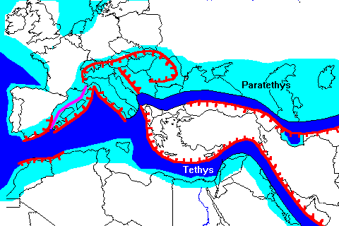
The Mediterranean, the Black Sea, and the southernmost Caspian sea are landlocked patches of ocean crust trapped by plate collisions. These basins are called trapped ocean basins and they are the only ones presently known on earth.
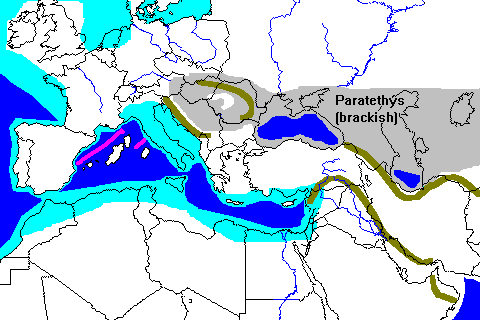 |
By about 15 million years ago plate collisions had shut the seaways of the Tethys and created mountain barriers in the Balkans and on both sides of Iran. However, with major rivers like the Volga and Danube draining into the former northern arm of the Tethys, the water had to go someplace.
The drainage divides northward to the Baltic are only about 160 meters (500 feet) above sea level, so for the water to drain to the Mediterranean, there would have to have been a lower outlet. |
But we can't just go assuming the Bosporus was the outlet. For one thing, uplift elsewhere in the Balkans may have raised former outlet valleys. There are a lot of mountain passes in the Balkans that look like former valleys left high and dry. Also, the Sea of Marmara didn't yet exist because the complex faulting that chopped up Greece and western Turkey hadn't really started yet. We can't assume the same land surface in this region; in fact we can't really even assume much of the Aegean was under water.
The most likely explanation is that the present Bosporus is a remnant of a north-flowing river system that has been mostly obliterated by faulting. There are a lot of ways the connection could have been established. Crustal movements could have dropped the floor of the Sea of Marmara and lowered the truncated valley enough to allow water to spill through from the Black Sea. Alternatively, water from the Mediterranean could have spilled over the drainage divide because of sea level rise, perhaps due to melting of the Pleistocene ice sheets. There's a hotly debated theory that the story of the Deluge and other flood accounts may have been inspired by sudden filling of the Black Sea basin. Other geologists argue that the Black Sea may have been suddenly filled from the east as large ice-dammed lakes in Siberia emptied into rivers and ultimately into the Black Sea.
References
Ali E. Aksu, Tom J. Calon, Richard N. Hiscott and Doan Yaar, Anatomy of the North Anatolian Fault Zone in the Marmara Sea, Western Turkey: Extensional Basins Above a Continental Transform, GSA Today, v. 10, no. 6, June 2000.
Rolando Armijo, Bertrand Meyer, and Aurelia Hubert, Westward propagation of the North Anatolian fault into the northern Aegean: Timing and kinematics; Geology: Vol. 27, No. 3, pp. 267-270.
Barka, A. A.; Kadinsky-Cade, K., 1988; Strike-slip fault geometry in Turkey and its influence on earthquake activity. Tectonics. vol. 7; no. 3, Pages 663-684. 1988.
Return to A Year in Turkey
Return to Professor Dutch's Home Page
Created 19 December 2003, Last Update 11 January 2020