Brent Structure, Ontario
Steven Dutch, Professor Emeritus, Natural and Applied Sciences, Universityof Wisconsin - Green Bay
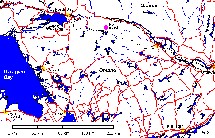
The only thing that bothers me just the teensiest bit about Brent is that it's right along the trend of the Ottawa Graben, with the Montreal diatremes and Oka carbonatite to the east and the Callander Bay alkalic complex to the west, and beyond that are Sudbury and Lake Wanapitei. The evidence for impact as a process on the earth is overwhelming, but the presence of so many impact structures along lineaments along with alkalic intrusions and diatremes nags me just a bit. I have a feeling that someday someone will find shatter cones and shock lamellae around an indisputably terrestrial structure and the whole can of worms will be open again. And as somebody once said, when you open a can of worms, it always takes a bigger can to hold them.
Brent is off a forest road about 25 miles from the Trans-Canada Highway. The worst imaginable place to hit a soft shoulder. Which I did when I visited this place on the way to my thesis area. I had to hike down to the railroad siding at Brent and wait several hours until a crew got off work and pulled me out with a scoop loader. I paid them well for their generosity.
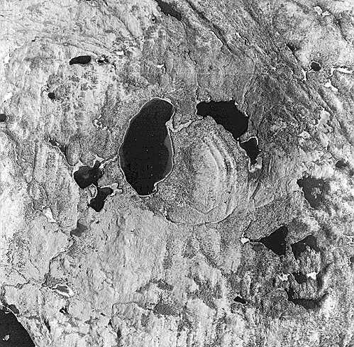
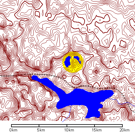
Aerial view of the Brent impact (photo from Natural Resources Canada). The rim of the crater is Precambrian crystalline rock but the floor is Ordovician limestone. Not far away atop the crystalline basement and above the crater fill is slightly older Ordovician limestone, so the age of this structure is closely bracketed as Ordovician.
 |
Imagine my surprise to drive so far off the beaten path and find
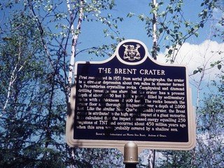
a bright, shiny historical marker. "First recognized in 1951 from aerial photographs, the crater is a circular depression about two miles in diameter formed in Precambrian crystalline rocks. The impact released energy equaling 250 megatons of TNT and occurred about 450 million years ago when this area was probably covered by a shallow sea." |
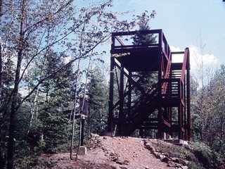 |
An observation tower, built for the 1972 International Geological Congress in Montreal, provides an overview of the crater. The historical marker was also installed for the IGC. |
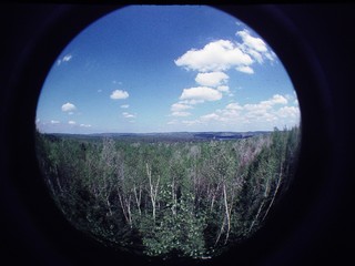 |
Fisheye view of the structure. The interior is roadless and accessible only on foot. |
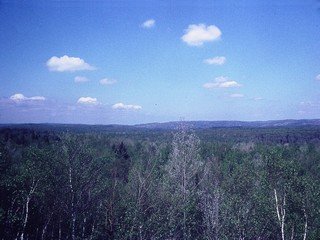 |
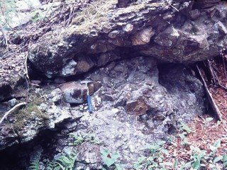
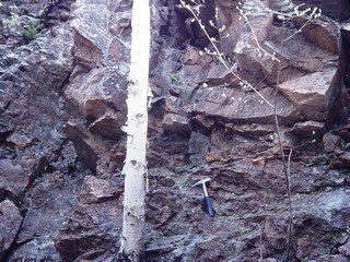
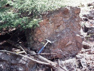
Left: View across the Brent Structure. The present structure is
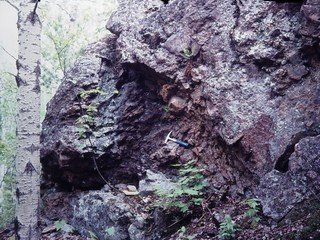
the result of erosion. The original crater has been obliterated by erosion. Below: A short trail down from the tower reveals outcrops of breccia which are believed to be collapse breccias resulting from landslides on the crater wall. Craters with similar interior landslides are common on the moon. |
 |
 |
 |
 |
Return to Historic Sites Index
Return to Virtual FieldTrips Index
Return to Professor Dutch's Home Page
Created 17 November 2005, Last Update 06 June 2020