Siesta Valley, California (CA Route 24)
Steven Dutch, Professor Emeritus, Natural and Applied Sciences, Universityof Wisconsin - Green Bay
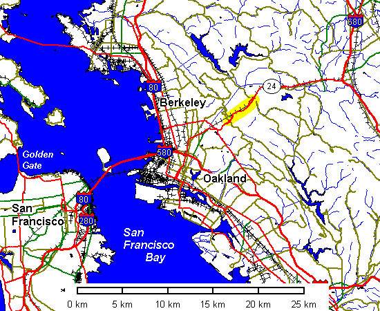
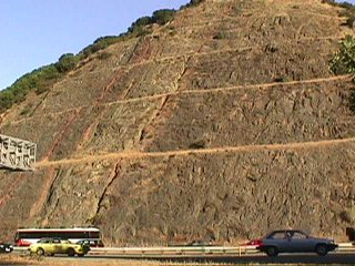
California State Highway 24 east of the Berkeley hills offers a cross-section of the Siesta Valley syncline. Not only is the syncline well exposed but it offers one of the most accessible examples of dramatic structural and geomorphic changes in a geologically short time. The cross-section cut is shown in yellow above.
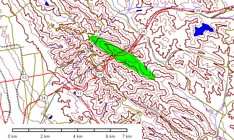
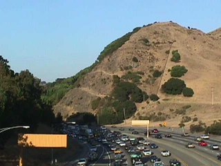
The Siesta Valley is in green above. The valley is underlain by marine clays and siltstones of the Siesta Formation. The ridges are held up by resistant volcanic rocks of the Moraga Formation. The break in slope on the southwest side of the hills is the Hayward Fault. Highway 13 follows the fault.
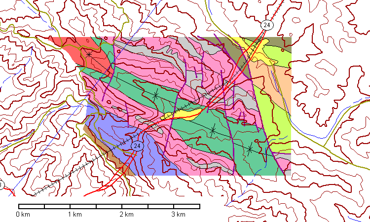
Geologic map of the Siesta Valley Syncline, after Graymer, Jones, and Brabb (1994). The Tertiary Claremont Formation is in brown at lower left. The Orinda Conglomerate is in blue. The Moraga Volcanics are light pink, and intercalated sedimentary rocks are gray. The Siesta Formation is green and the Bald Peak Volcanics are dark pink. Faults are dark purple. The railroad running across the area is the Bay Area Rapid Transit (BART) line. The syncline is offset slightly by a few faults but is basically NW trending with a slight NW plunge.
The Orinda Conglomerate contains pebbles of Franciscan metamorphic rocks, which are not exposed anywhere in the vicinity, but which occur abundantly in the Coast Ranges to the west. But west of the Berkeley hills today is San Francisco Bay, which obviously did not exist when the Orinda Conglomerate was deposited. The Moraga Volcanics have been dated at about 11 m.y. old and the Bald Peak Volcanics at about 8 m.y.old. Therefore, in the last 8 m.y., these rocks have been folded into a moderately tight syncline and eroded to their present level.
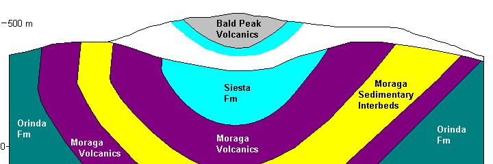
Above: cross-section across the Siesta Valley Syncline, no exaggeration. The lower topographic profile is along the BART line, after Rogers and Peck (2000). The upper profile is parallel to it and about 2 kilometers further north.
 |
At the west end, CA 24 emerges from the Caldecott Tunnel through the Berkeley hillsand into a deep road cut. Looking northwest, we see blue-gray Orinda Conglomerate dipping northeast (right) |
 |
The eastern contact of the conglomerate, overlain by Moraga Volcanics
(brown). Below: southeast side of the cut, with blue-gray Orinda Conglomerate on the west (right) and Borown Moraga Volcanics on the east (left). |
 |
 |
 |
Moraga volcanics with a sedimentary interbed. |
 |
Outcrop of Orinda Conglomerate. |
 |
Closeup of Orinda Conglomerate |
 |
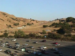
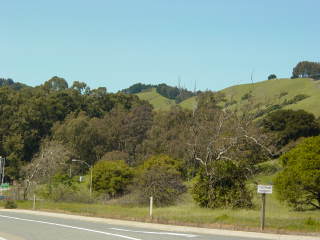
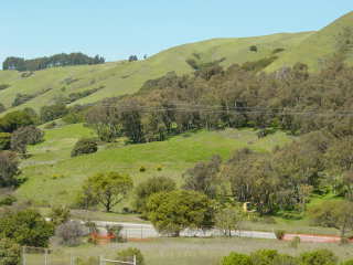
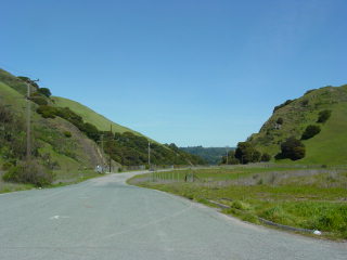
Looking east across the valley. The near roadcut is the western flank of the syncline; the far ridge is the eastern flank. |
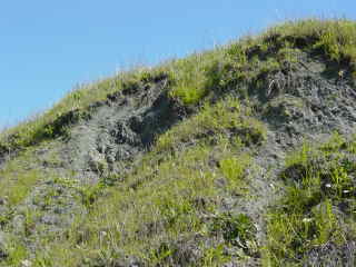 |
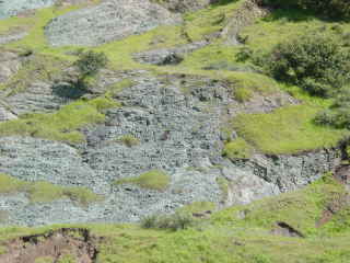
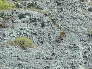
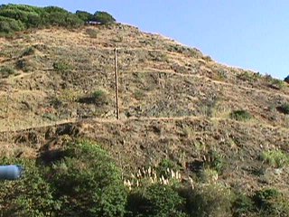
Left and below: Speaking of an "outcrop" of the Siesta Formation is insulting to any self-respecting rock that really does form outcrops, but its very softness makes it easy to expose in cuts. |
 |
|
 |
Left: looking southeast along the axis of the syncline.
|
 |
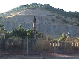
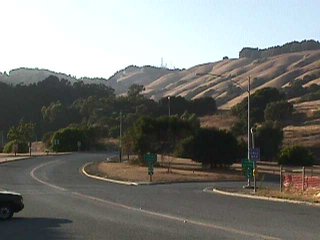
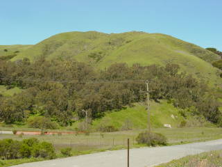
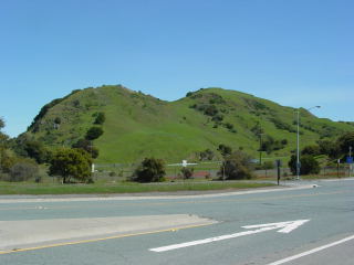
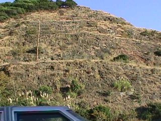
Left and below: looking northwest along the axis of the syncline. The distant hill on the skyline with the towers stands in relief because it is underlain by Bald Peak Volcanics. |
 |
 |
 |
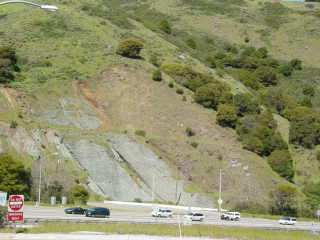
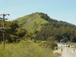
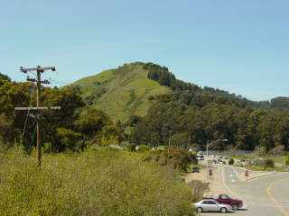
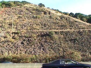
Left and below: the western side of the syncline. The ridge is held up by Moraga Volcanics. |
 |
 |
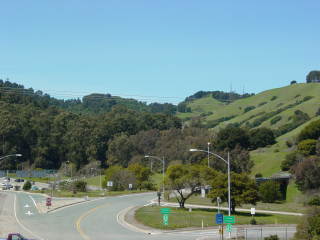
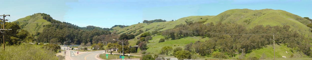
Below: panorama of the syncline, looking northwest. The flanking ridges are supported by Moraga Volcanics. The valley lowland is the easily eroded Siesta Formation, and the distant hills on the skyline are underlain by Bald Peak Volcanics.
 |
 |
 |
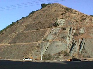
Above: The eastern ridge of Moraga Volcanics. Left and below: The highway cut through the eastern ridge. |
 |
|
 |
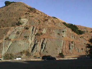
The ridge of Moraga Volcanics south of Highway 24. The southern terminus of the ridge is a fault. |
 |
Eastern cut through the Moraga Volcanics. |
 |
Left and below: Outcrops of Moraga Volcanics in the eastern cut. |
 |
 |
Rogers, J. D. and Peck, R. B., 2000; Engineering Geology of the Bay Area Rapid Transit (BART) System, 1964-75; http://www.sonic.net/~mly/www.geolith.com/bart/ (September, 2005)
R.W. Graymer, D.L. Jones, and E.E. Brabb, 1994; Bedrock geologic map of Contra Costa County (USGS OFR 94-622), http://pubs.usgs.gov/of/1994/of94-622/ (November 2005)
Return to Historic Sites Index
Return to Virtual FieldTrips Index
Return to Professor Dutch's Home Page
Created 19 November 2005, Last Update 08 June 2020