Carolina "Bays"
Steven Dutch, Professor Emeritus, Natural and Applied Sciences, Universityof Wisconsin - Green Bay
The Carolina Bays aren't conspicuous on maps because they have very little relief, but sometimes the outlines of larger ones are plotted. Above is a fairly typical example from eastern North Carolina.
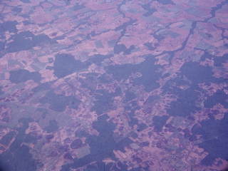 |
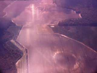
Thousands of small elliptical depressions dot the Atlantic Coastal
Plain from Maryland to South Carolina, but the heaviest concentration
is in the Carolinas. These depressions are nicknamed "bays." Below are details of some of the bays in the photo at left. Note that the bays have parallel long axes. |
 |
 |
 |
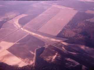
Bays typically have shallow depressions in the center and slight raised rims. The one in the photo at left has been completely plowed over but is outlined by a ring of light colored soil. |
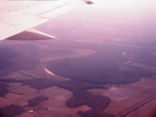 |
This bay has been left as woodland |
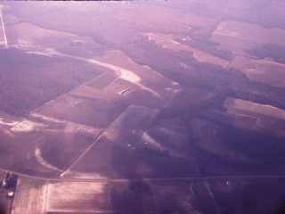 |
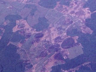
Portions of at least four bays are visible in this picture. |
 |
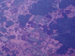
Three bays of different sizes are visible in this photo. |
Bays persistently turn up on amateur lists of meteor impact craters, but they are definitely not due to impact.
- There is no meteoritic material associated with them.
- The elliptical shape invites speculation about oblique impact. In fact, only the most grazing impacts produce elliptical craters. A crater is due to the instantaneous release of a meteorite's kinetic energy as heat, and that process will not depend on trajectory. Oblique impacts do produce a distinctive ejecta pattern. Ejecta is not thrown backwards toward the direction of approach, and ejecta thrown in the direction of travel will be flung upward. The only places ejecta will be hurled around the crater rim will be off to the sides, producing a two-lobed "butterfly" pattern. The bays show no hint of such a pattern.
- Impacts melt the target material, and impacts large enough to create these bays should have penetrated the soil, excavated bedrock, and produced distinctive signs of intense disturbance in the bedrock. There should also be plenty of bedrock ejecta around the bays. None of these features are present.
The formation mechanism of the bays is still imperfectly known but most geologists suspect they are the result of chemical weathering in a warm, moist climate with poor drainage.
Return to Historic Sites Index
Return to Virtual FieldTrips Index
Return to Professor Dutch's Home Page
Created 20 January 2005, Last Update 06 June 2020