Cascade Range Volcanoes Compared
Steven Dutch, Professor Emeritus, Natural and Applied Sciences, University of Wisconsin - Green Bay
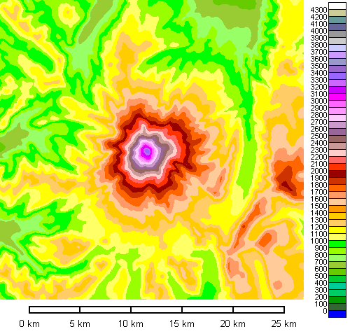
This page presents maps of the major Cascade Range volcanoes to a common scale, together with photos for most of them. Some peaks like Mount Lassen turn out to be rather small cones that owe their prominence to being built on a high base. Mount Shasta and Mount Rainier are as massive as their height suggests. Mount Adams, which lies east of the chain and is less well known than Mount Rainier or Mount St. Helens, turns out to be a really impressive cone.
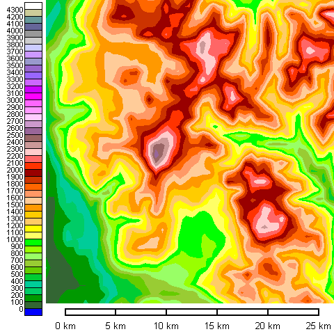
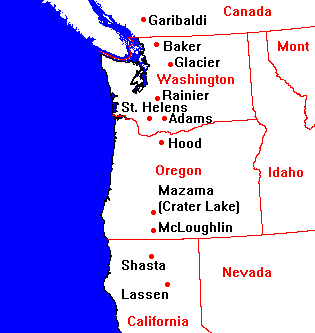 |
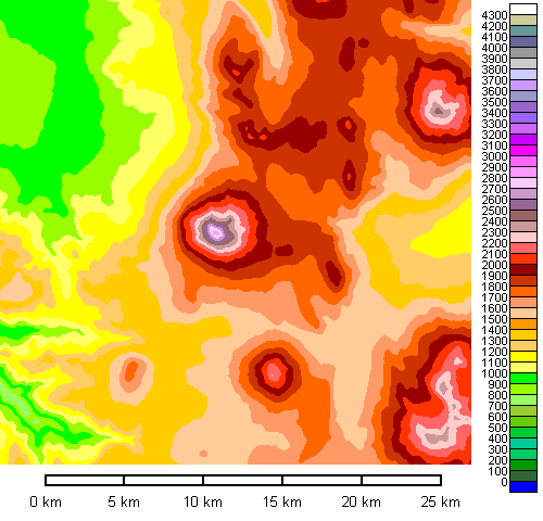
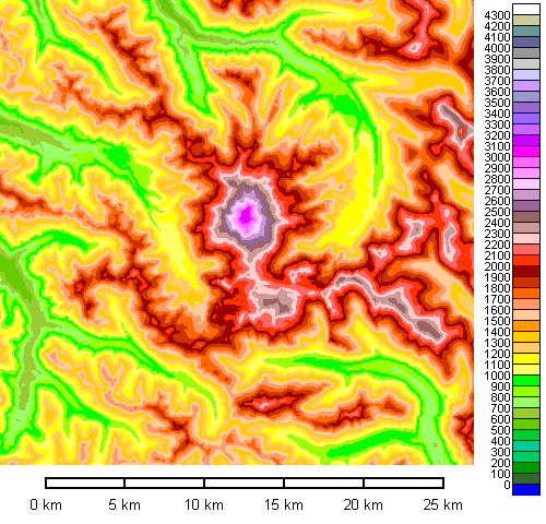
The index map at left shows the principal Cascade volcanoes |
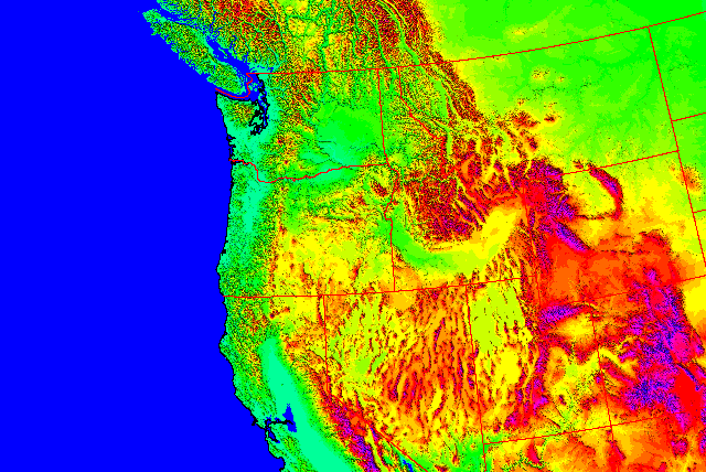
Long before plate tectonics, Western geologists were struck by the fact that Mount Lassen, the southernmost Cascade vent, is at exactly the latitude of Cape Mendocino in California, aligned with the Mendocino Fracture Zone and the northern terminus of the San Andreas Fault. Surely there had to be a connection.
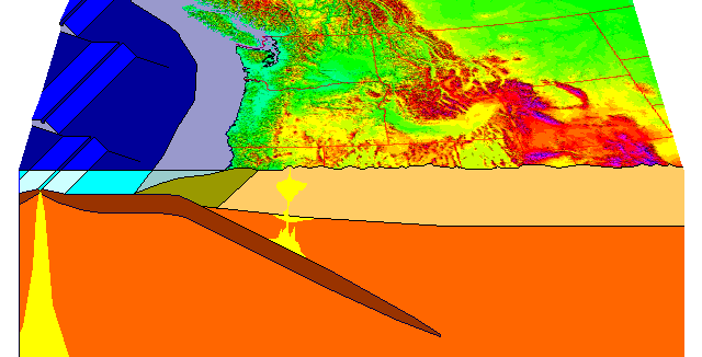
There is. From Cape Mendocino to southern British Columbia, a small plate, the Gorda or Juan de Fuca Plate, is being subducted beneath North America. This is the disconnected remnant of the Farallon Plate, which once covered the whole eastern Pacific. The present Cocos and Nazca Plates off Central and South America are also remnants of the former Farallon Plate.
The subduction zone off the Pacific Northwest (called the Cascadia Subduction Zone) is unique in lacking a trench. The reason is that unlike any other subduction zone, a major river, the Columbia, empties directly into the subduction zone and its sediment fills in the trench. As if that's not enough, the Lake Missoula floods of the Pleistocene dumped huge quantities of material into the trench.
The relatively slow movement of the Gorda Plate means comparatively little magma production and thus a low rate of volcanism and seismicity. Also, sediment seems to play a role in lubricating subduction zones, and the Cascadia Subduction Zone is probably the gooshiest (that's a highly technical plate tectonics term) in the world. Nevertheless, it can and does produce major earthquakes. There is evidence to suggest a very large event (possibly Magnitude 9) about 1700. The Cascadia Subduction zone is a prime concern of disaster planners and Roland Emmerich script writers.
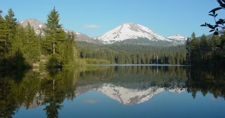
Mount Lassen, California
 |
3188 meters (10457 feet)
Mount Lassen isn't in Lassen County, but in Shasta County. Until 1980, this was the most recently active volcano in the continental United States. This is the postcard view from Manzanita Lake. |
 |
Mount Lassen sits on the northern rim of a caldera created by the collapse of a former peak that has been given the name Mount Tehama. Mount Tehama isn't in Lassen County either. It isn't even in Tehama County. It's also in Shasta County.
The only part of the caldera still evident is the ragged northern edge, seen here from about 50 kilometers to the south. Mount Lassen is the high peak on the right. |
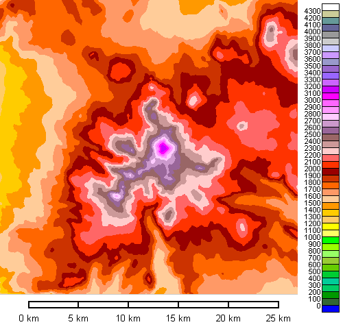
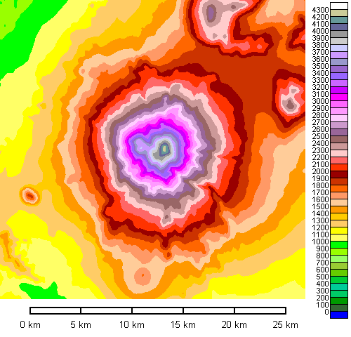
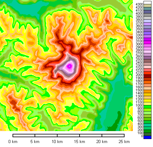
Mount Shasta, California
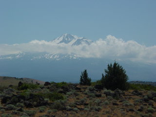 |
4318 meters (14162 feet)
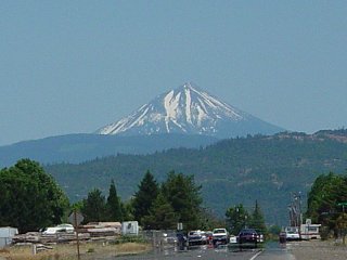
In keeping with the bizarre mismatch of place names, Mount Shasta isn't in Shasta County. It's in Siskiyou County. The Siskiyou Mountains, however, are mostly in Oregon. By the way, Cape Mendocino, where the San Andreas Fault and the Cascadia Subduction Zone meet, isn't in Mendocino County, either. It's in Humboldt County. Are we all clear on this? Mount Shasta is truly an immense mountain, and has the greatest volume of any Cascade volcano. Although its parasitic cone Shastina is conspicuous from the ground, in map view it is a minor bump on an otherwise almost perfect cone. |
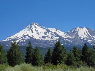 |
From the north, showing the summit and Shastina to the right. |
Mount McLoughlin, Oregon
 |
2895 meters (9495 feet)
Mt. McLoughlin, at just under 3000 meters elevation, is a near twin of Mount Saint Helens before it collapsed in 1980 (in size - not in eruptive frequency). From the easiest viewing angles near Medford it looks like a perfect cone but is actually somewhat dissected. |
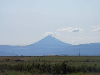 |
From the east side of Klamath Lake. |
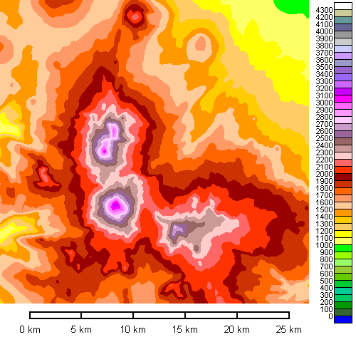
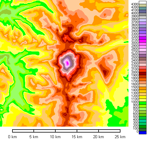
Mount Mazama (Crater Lake), Oregon
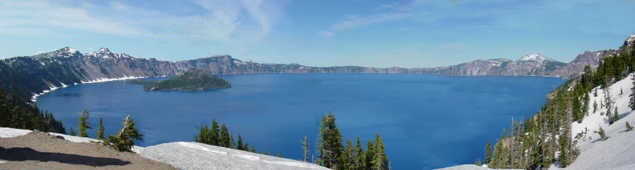
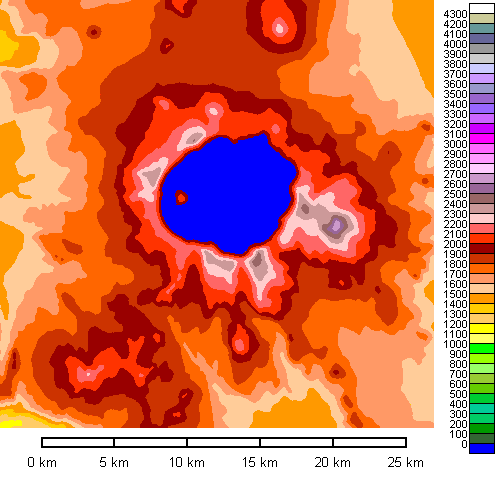 |
Present highest point on rim 2490 meters (8166 feet) Pre-eruption height (estimated) 3500 meters (11500 feet) Mount Scott (highest peak east or rim) 2725 meters (8938 feet) Crater Lake is the remnant of a former large stratovolcano which collapsed about 6000 years ago. |
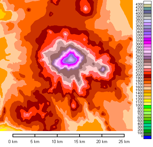 |
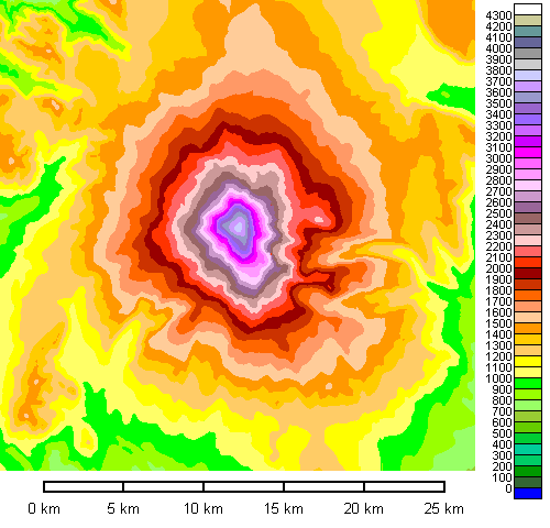
In terms of diameter and shape at the right elevation, Mount Adams is a pretty close match to the rim of Crater Lake. Grafting the summit onto the map above gives us an idea what Mount Mazama may have looked like. |
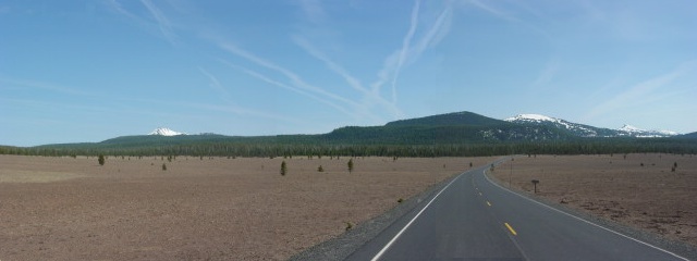
| The best place to see the broken stump of Mount Mazama is north of Crater Lake in the Pumice Desert |
 |
| Possible pre-collapse appearance of Mount Mazama. |
 |
Three Sisters, Oregon
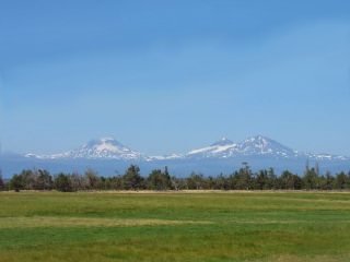 | South Sister 3158 meters (10358 feet) Middle Sister 3063 meters (10047 feet) North Sister 3075 meters (10085 feet) From just north of Bend. |
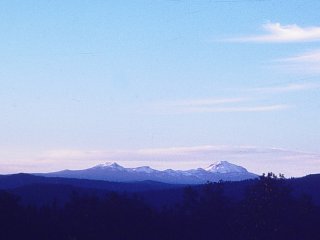
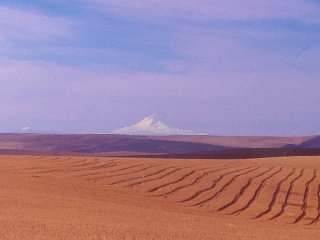
Mount Jefferson, Oregon
 |
3200 meters (10497 feet) |
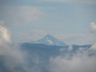 |
View from Larch Mountain |
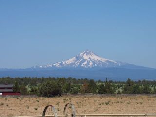 |
From the east, north of Bend. |
Mount Hood, Oregon
 |
3427 meters (11239 feet) |
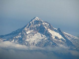 |
 |
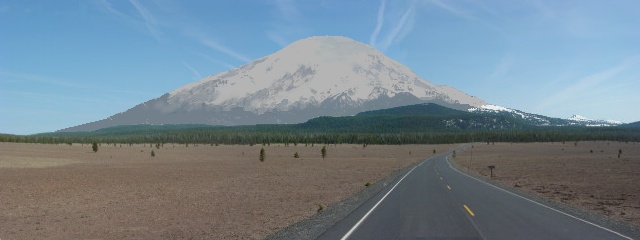
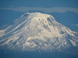
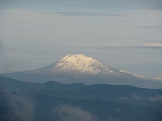
Mount Adams, Washington
 |
3743 meters (12276 feet) Mount Adams is one of the lesser known Cascade summits, some 600 meters lower in elevation than Rainier or Shasta. But in terms of mass, it is not far behind them. |
 |
 |
Mount Saint Helens, Washington
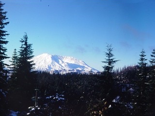 |
Present highest point: 2550 meters (8365 feet) Pre-1980 summit: 2950 meters (9677 feet) Before its spectacular collapse in 1980, Mount Saint Helens had the most perfect cone of any Cascade Range volcano. At a bit under 3000 meters in elevation, it was only a modest peak, but it was the youngest and most active volcano in the Cascades. |
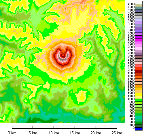
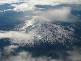
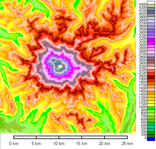
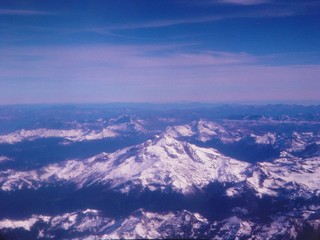
Mount Rainier, Washington
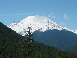 |
4394 meters (14411 feet)
Mount Rainier is the highest Cascade volcano and, after Shasta, the most massive. It has the most extensive glacier system by far, and therefore presents the greatest mudflow hazard if it erupts. |
Glacier Peak, Washington
 |
3214 meters (10541 feet)
The easiest way to get a good view of Glacier Peak is to fly to Seattle and get lucky. |
Mount Baker, Washington
3287 meters (10781 feet)
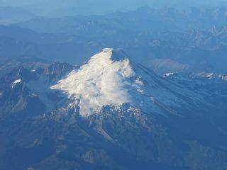 |
Airplane view from the south |
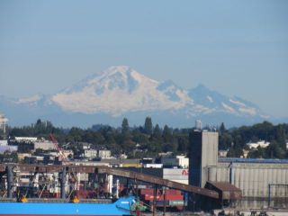 |
Mount Baker is prominently visible from Vancouver. |
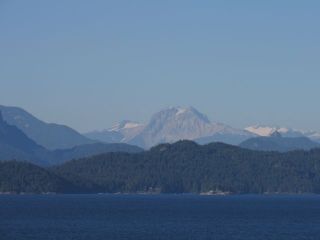
Mount Garibaldi, British Columbia
2679 meters (8787 feet)
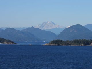 |
Mount Garibaldi is lower and less prominent than most Cascade Range peaks. It's also less regular and heavily eroded, and presents very different outlines from various places. It last erupted about 10,000 years ago and erupted onto glaciers during the Pleistocene. |
 |
Return to Historic Sites Index
Return to Virtual FieldTrips Index
Return to Professor Dutch's Home Page
Created 7 April 2003, Last Update 07 June 2020