Yosemite Falls Trail
Yosemite National Park, California
Steven Dutch, Professor Emeritus, Natural and Applied Sciences, Universityof Wisconsin - Green Bay
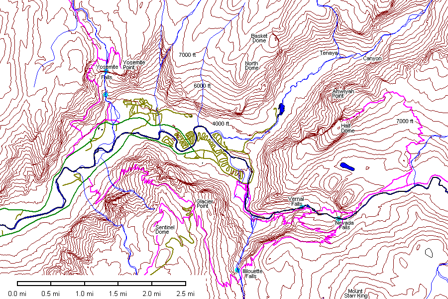
Location map for eastern Yosemite Valley. Selected major trails are in purple.
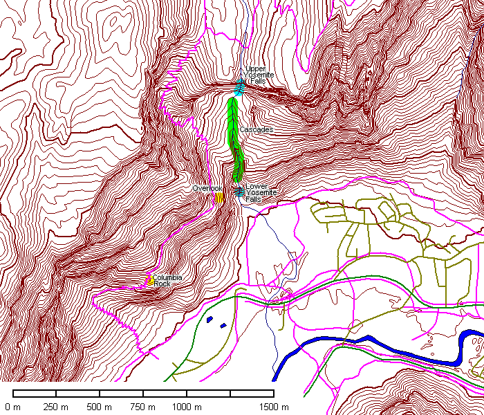
Detailed map of the Yosemite Falls trail.
 |
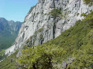
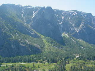
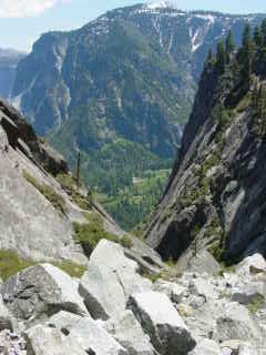
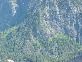
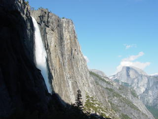
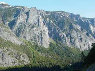
Note that Yosemite Falls drops off a cliff even though there's a
deep valley right next door. Notches like this are described as "mysterious" by one well-known book on Yosemite. They're mysterious only if we discount the obvious idea that they are former valleys. The cliff on the left has such ragged fracture surfaces that it seems quite possible that this is a former valley blocked by a landslide. |
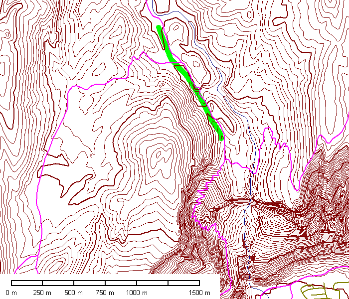
The map above, showing the area above the falls, shows clear evidence of an abandoned incised drainage (green). How this drainage came to be abandoned is uncertain, but it may have been blocked by stagnant ice or by glacial deposits now eroded away.
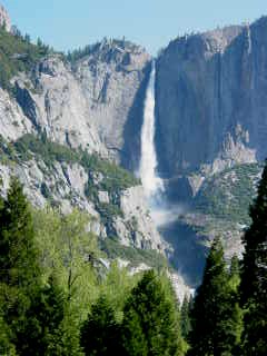 |
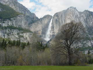
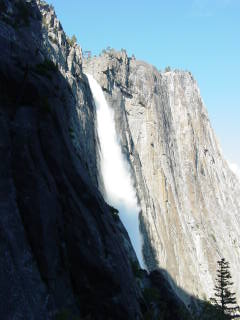
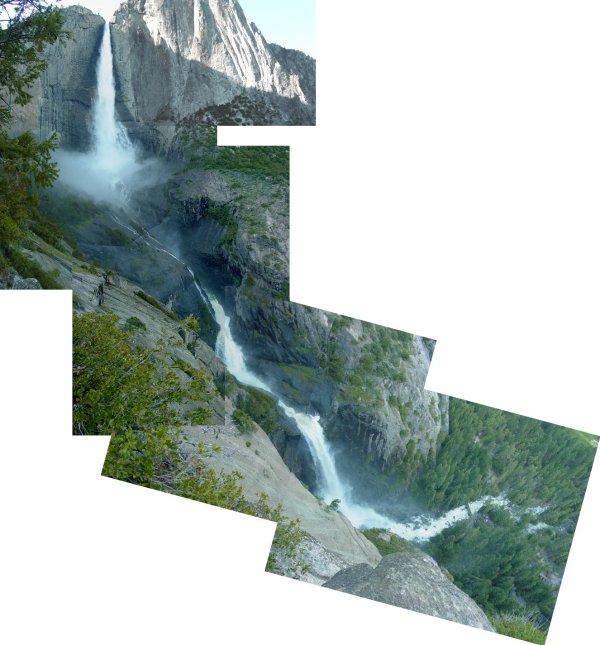
Yosemite Falls is the highest waterfall in Yosemite. The total drop
is 740 meters or 2425 feet. The upper fall is 1430 feet (435 m), a series
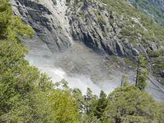
of cascades drops 675 feet (205 m) and the lower falls drops 320 feet
(98 m). There is actually a higher free-falling waterfall in Yosemite. A small ephemeral fall, Ribbon Falls, drops 1612 feet off the cliffs west of El Capitan. It is the highest free-falling waterfall in North America. |
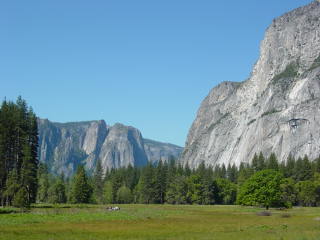 |
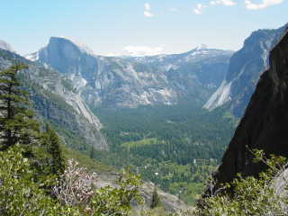
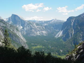
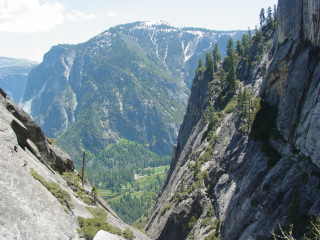
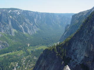
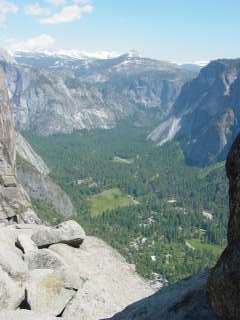
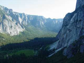
Looking west down Yosemite Valley from near Yosemite Falls |
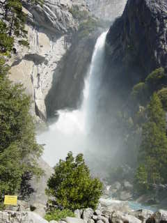 |
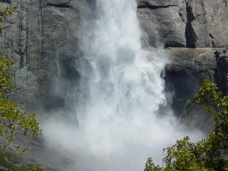
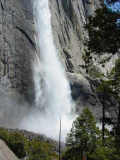
Lower Yosemite Falls. |
 |
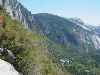
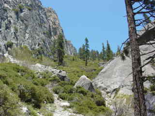
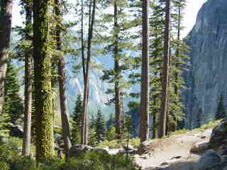
The trail to the top of Yosemite Falls starts half a mile down-valley from Yosemite Creek, zigzags up a talus pile and then follows a ledge to Columbia Rock, about 1000 feet above the valley floor. |
 |
 |
 |
 |
 |
 |
 |
|
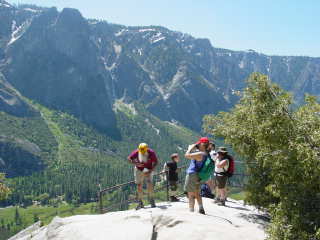 |
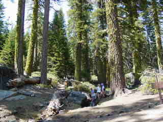
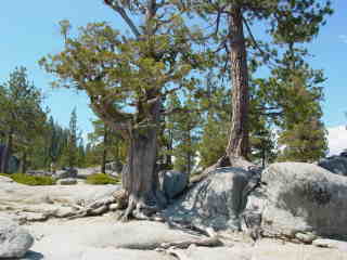
Hikers at Columbia Rock |
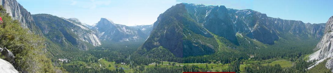
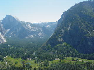
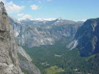
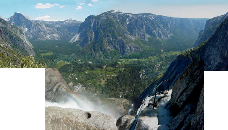
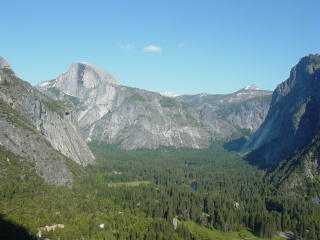
Panorama from Capitol Rock. Half Dome is at left center and Glacier Point is the massive buttress in center.
 |
From Columbia Rock the trail runs slightly downhill to the base of Yosemite Falls. |
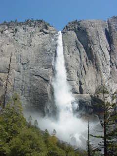 |
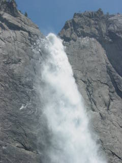
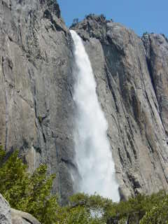
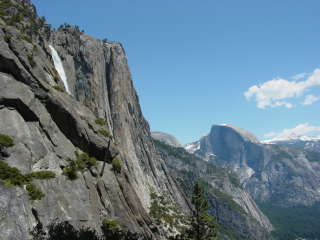
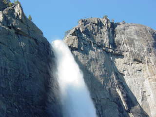
Looking up Upper Yosemite Falls. |
 |
 |
 |
 |
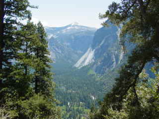 |
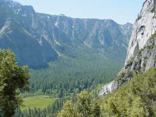
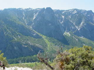
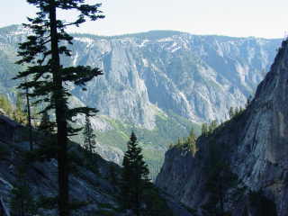
Once at the base of Yosemite Falls, the trail ascends the Talus Pile from Hell, an endless series of switchbacks but offering great views as compensation. This view is looking into Little Yosemite Valley. |
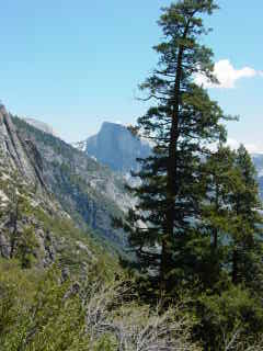 |
As the trail ascends, Half Dome comes into view. |
 |
About halfway up the upper falls. |
 |
Upper Yosemite Valley. |
 |
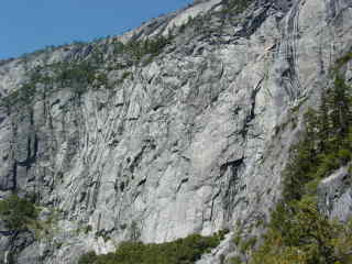
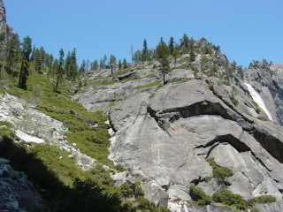
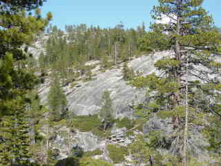
This picture and the one below show the steep joint sets that define the walls of Yosemite Valley. |
 |
Below: Looking up the Talus Slope From Hell. Not only are the switchbacks forever, but the trail is beaten to a pulp and rocky. |
 |
 |
 |
Near the top, the high Sierra come into view.
Below: Last glimpses of Yosemite Falls from the trail. |
 |
|
 |
 |
| Above: Looking back down the trail notch. | Below: the ragged walls of the cliff at the top of the talus slope strongly suggest the scar of a rockfall. |
 |
 |
 |
Left: The end draws near. Below: And suddenly, there it is. |
 |
 |
 |
Yosemite Valley from the top of the trail. |
 |
 |
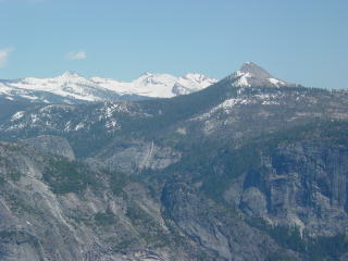 |
The high Sierra are still snow-covered in June. 9000-foot Mount Starr King is the conical peak. It's 2000 feet lower than the distant peaks but looks higher because it's closer. |
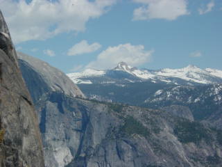 |
Half Dome is half hidden on the left. Mount Clark (11522 ft, 3512 m) is the sharp distant peak. |
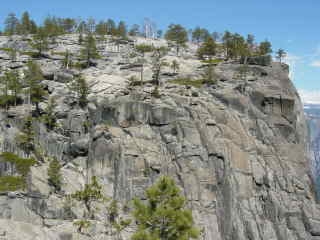 |
Yosemite Point |
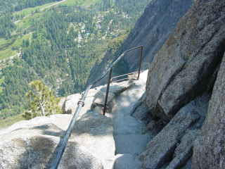 |
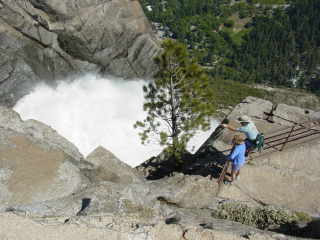
Even with a handrail, the trail down to the overlook at the top of the falls is not for acrophobes. |
 |
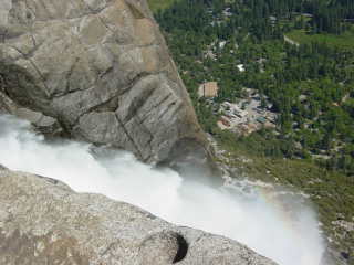
Yosemite Falls and the valley floor half a mile below. |
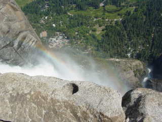 |
Rainbow |
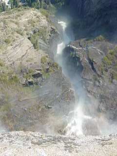 |
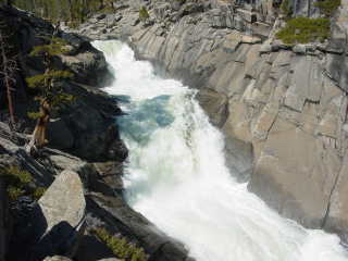
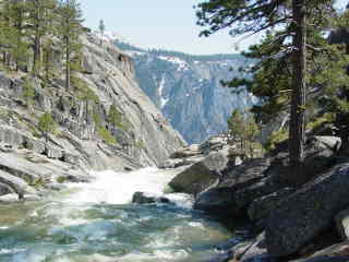
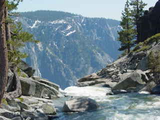
The cascades have cut an amazingly narrow cleft in the rocks. |
 |
 |
 |
|
 |
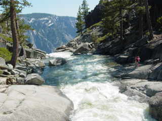
Yosemite Creek on its way to the edge. The vertical joints that shape the valley walls are visible in the wall at right. A steep west-dipping joint set defines the wall while subhorizontal joints extend along the wall. The subhorizontal joints control some of the steps in the valley walls. |
 |
Massive talus cone on the far side of the valley. |
 |
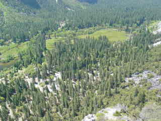
On the low ridge separating the ascent chute from Yosemite Creek. |
 |
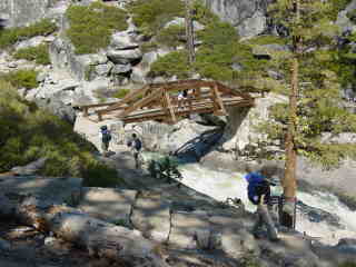
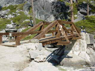
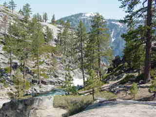
 |
| Above: The valley of Yosemite Creek. | Below: Footbridge over Yosemite Creek. |
 |
 |
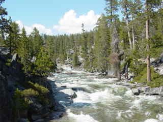 |
Left: Looking upstream from the bridge Below: Looking downstream. |
 |
 |
 |
Flattened xenoliths in the granodiorite. |
|
|
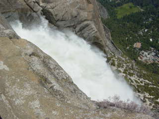
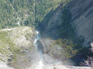
Looking down Yosemite Falls and over the edge. |
 |
 |
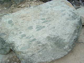 |
Flattened xenoliths in the granodiorite. |
Creating a panorama that spans large horizontal and vertical angles is reminiscent of the old comment about a dog walking on its hind legs: it's not so much surprising that it is done well, but that it is done at all. This is a composite from several different nearby vantage points. Half Dome is at upper left, Glacier Point is the promontory across the valley and Sentinel Dome is the snow-covered bare summit, the highest point on the skyline.
 |
Late afternoon view down the trail notch. |
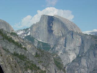 |
Half Dome. |
 |
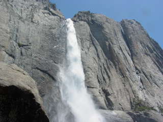
Lip of Yosemite Falls |
 |
Late afternoon views of the falls on the descent. |
 |
 |
 |
Half Dome and upper Yosemite Valley |
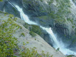 |
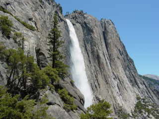
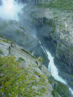
Left and below: about the only place to get a complete view of the entire falls is from a short spur just beyond Columbia Rock where there is an overlook into the Cascades and Lower Yosemite Fall. |
 |
|
 |
Lower Yosemite Falls. Below is a composite of the entire falls system. The footbridge below Lower Yosemite Falls is visible at extreme lower right. |
 |
Late afternoon views from Columbia Rock In the cleft near the center of the photo at left and below is Sentinel Falls. |
 |
 |
 |
 |

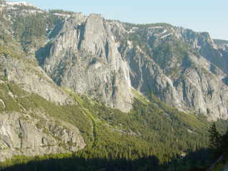
Late afternoon panorama from Capitol Rock. The deeply embayed south wall of the valley at right is obviously the result of multiple landslides and rockfalls.
Return to Historic Sites Index
Return to Virtual FieldTrips Index
Return to Professor Dutch's Home Page
Created 30 January 2006, Last Update 10 June 2020