Zion National Park, Utah
Steven Dutch, Professor Emeritus, Natural and Applied Sciences,
Universityof Wisconsin - Green Bay
| Cretaceous | Dakota Sandstone |
| Jurassic | Carmel Formation |
| Temple Cap Formation | |
| Navajo Sandstone | |
| Kayenta Formation | |
| Moenave Formation | |
| Triassic | Chinle Formation |
| Moenkopi Formation | |
| Permian | Kaibab Limestone |
| Toroweap Limestone |
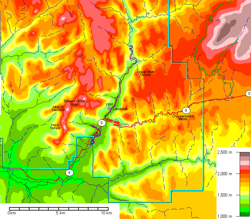
Note the straight streams all trending about 350 degrees east of Zion Canyon, controlled by joints.
How long did it take to cut Zion Canyon? At Virgin, Utah, just outside the park, the U.S. Geological Survey sediment gauge measures about a million metric tons of suspended sediment a year. Assuming porous sandstone weighs 2000 kg/cubic meter (2 metric tons/cubic meter), that is the equivalent of 500,000 cubic meters of rock per year. More than half of that moves during only one per cent of the year, during major storms.
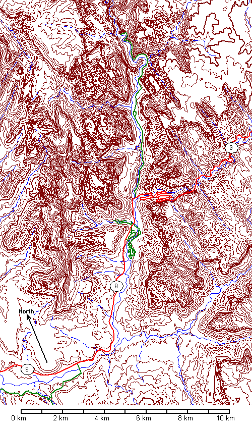
The canyon is about 5 km wide at its mouth and 800 meters deep, and it's about 15 kilometers from the mouth to the end of the road. We can model the shape of the canyon as a pyramid on its side. The base has an area of 5000 x 800/2 square meters, or 2,000,000 square meters. The height of the pyramid is 15000 meters (remember the pyramid is laying on its side). The volume of a pyramid is Ah/3, where A is the area of the base. So the volume of the lower canyon is about (2,000,000)(15,000)/3 = 10 billion cubic meters. At 500,000 cubic meters of rock being moved per year, the time to cut the canyon is an incredibly short 20,000 years!
That's just a mind-bogglingly small answer and is clearly way too short because we've ignored all the tributary canyons and the watershed upstream from the main canyon. So let's try a far more conservative approach. Using a digital elevation model and a GIS program, the area draining through the sediment gauging station is about 1.9 billion square meters or 1,900 square kilometers. Let's model the area to be excavated as an inverted pyramid with base area of 1.9 billion square meters and altitude 800 meters. This is a conservative approach because now we're ignoring all the spurs that are still standing between the valleys. The volume comes to (1.9 billion)(800)/3 or about 500 billion cubic meters. With 500,000 cubic meters being removed annually, we get a million years to dissect the topography. That's not long in geologic terms.
Any way we look at it, the Virgin River is going through the rocks like a chain saw. Elsewhere in the Colorado Plateau there are volcanic rocks 1 to 2 million years old cut by equally deep canyons. A million years to cut this landscape is quite consistent with the regional geology.
 |
|
 |
|
 |
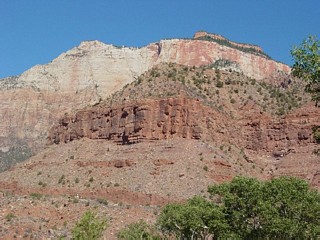
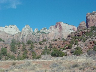
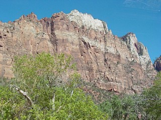
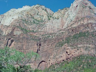
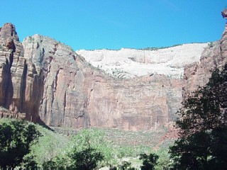
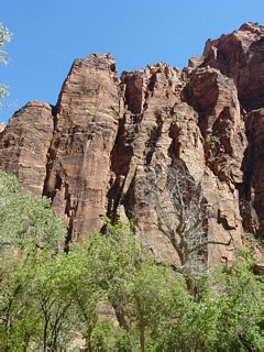
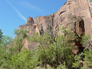
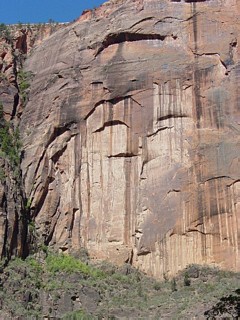
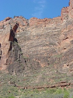
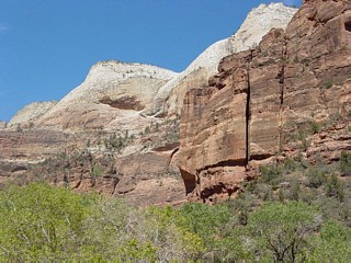
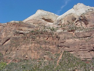
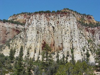
Navajo Sandstone makes up the high cliffs, pink at the base and grading up to white. The brushy slopes beow the high cliffs are Kayenta Formation. Moenave Formation makes up the lower red cliffs and Chinle Formation forms the lowest slopes. |
 |
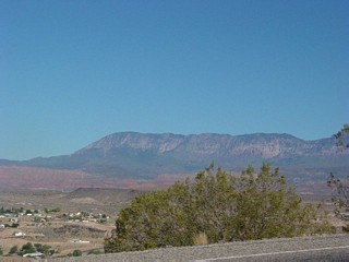
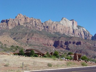
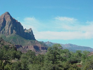
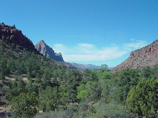
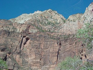
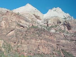
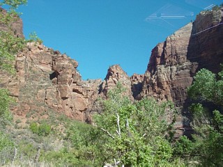
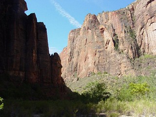
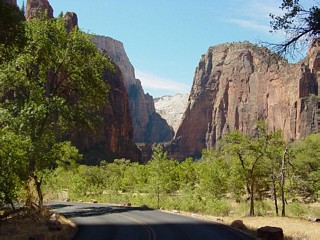
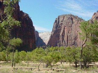
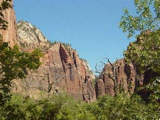
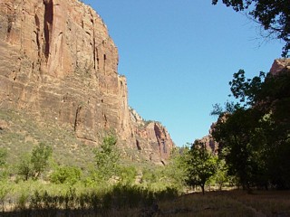
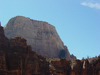
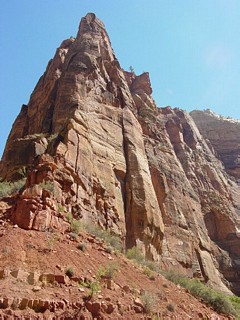
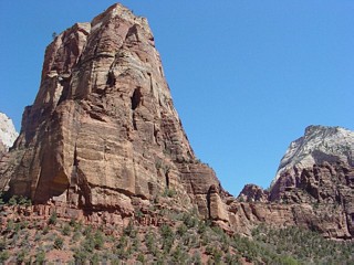
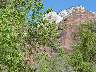
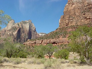
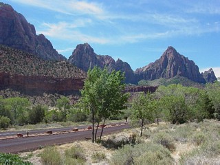
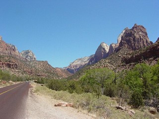
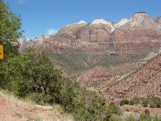
Approaching the entrance to Zion Canyon. The large rectangular peak at right is the West Temple. |
 |
|
 |
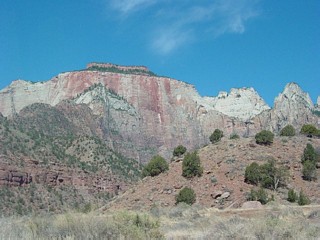
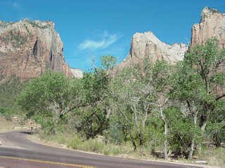
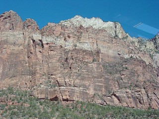
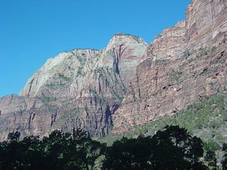
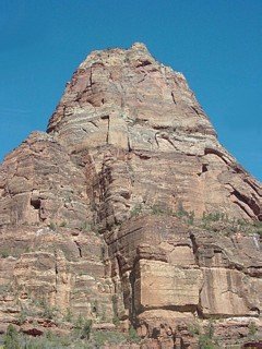
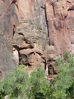
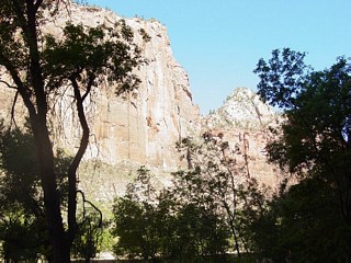
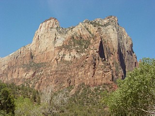
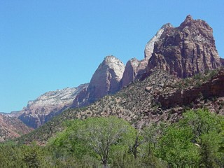
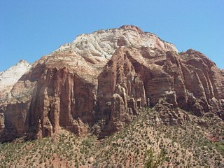
Left and below: The large rectangular cliff is the West Temple, made of Navajo Sandstone. The thin layer on top is the Temple Cap Formation. Thin-bedded red Moenave Formation makes up the bluffs in the foreground. The slopes above the cliffs are the Kayenta Formation. |
 |
 |
 |
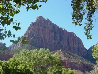
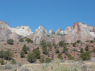
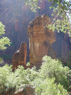
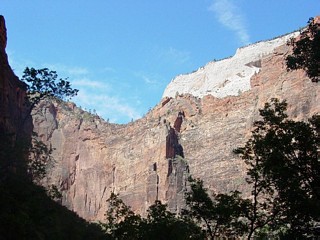
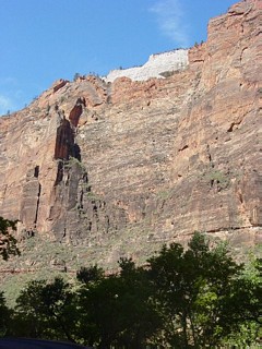
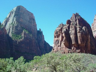
Below: Towers of the Virgin. The lurid iron stains running down one tower gave it the name Altar of Sacrifice. |
 |
 |
 |
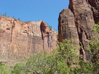
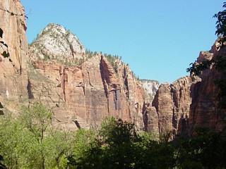
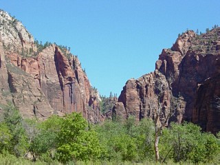
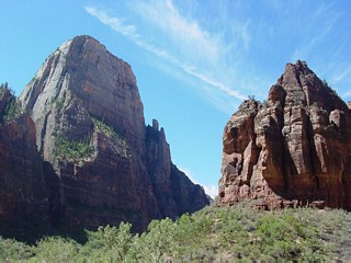
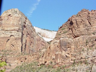
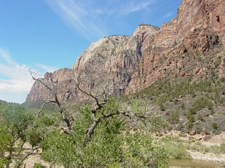
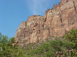
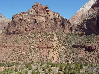
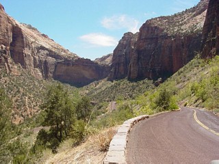
Left: view south out of the canyon. |
 |
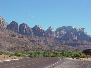
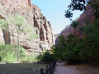
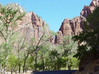
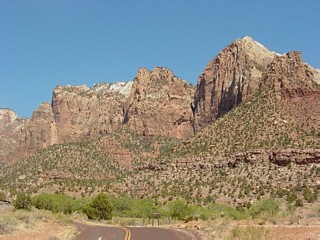
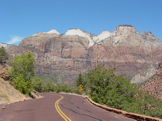
En route into the canyon. Zion has the same traffic problems as Yosemite, in spades. It's narrow and even more confined. The canyon is so confined that most of the year private vehicles are banned and free shuttle buses provide transportation. The system works because it's free and frequent. Mass transit activists, are you listening? |
 |
 |
 |
 |
 |
 |
 |
 |
 |
 |
 |
 |
 |
 |
 |
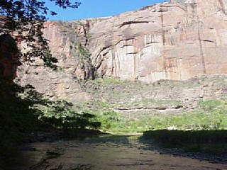
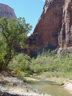
The Temple of Sinawava is the end of the road. Here the Virgin River exits a slot canyon. |
 |
 |
 |
 |
 |
 |
 |
 |
 |
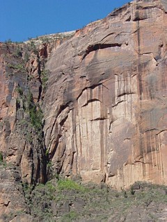
Desert varnish streaks a cliff of pink Navajo Sandstone. |
 |
 |
 |
|
 |
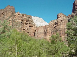
Looking south down canyon. The Great White Throne peeks over the cliff at left. |
 |
 |
 |
 |
 |
 |
 |
 |
 |
 |
 |
 |
|
|
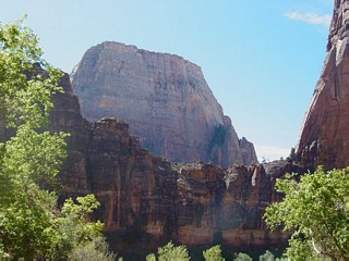 |
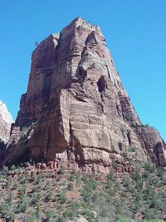
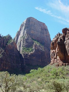
Zion's equivalent of Half Dome is the Great White Throne, a huge monolith of Navajo Sandstone. |
 |
 |
 |
 |
 |
 |
 |
 |
 |
 |
 |
 |
 |
 |
 |
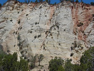
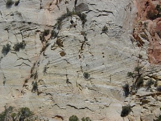
Cross-bedded Navajo Sandstone. |
 |
 |
 |
 |
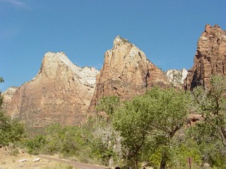 |
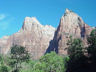
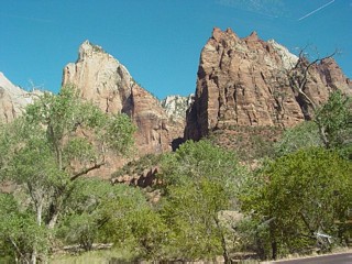
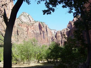
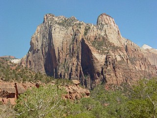
The Court of the Patriarchs. From left to right they are Abraham, Isaac and Jacob. |
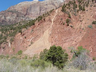 |
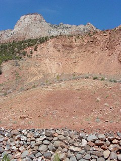
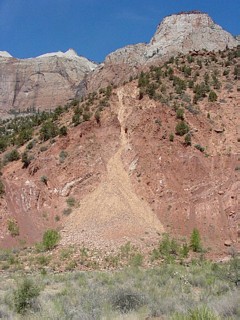
The 1995 landslide. |
 |
 |
 |
 |
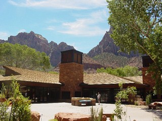 |
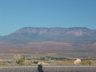
The Visitor Center. Below: Views east along Utah Route 9. |
 |
 |
 |
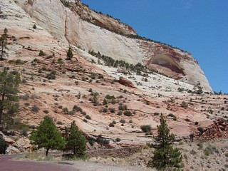
Left and below: Utah Route 9 east out of the park offers spectacular views but unfortunately no turnouts. |
 |
 |
 |
 |
 |
 |
 |
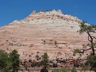
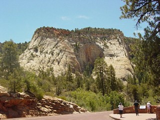
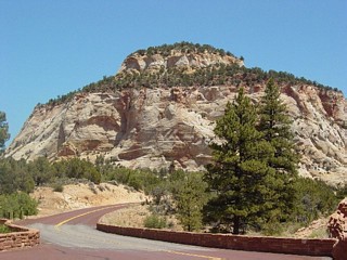
Navajo Sandstone makes up the entire peak, pink at the base, white at the top. |
 |
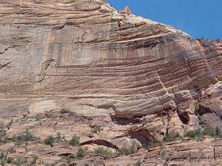
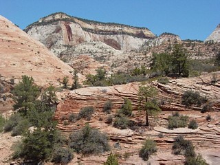
East of the tunnel, the road winds through the Navajo Sandstone with its famous dune cross-bedding. This is the largest dune field in the geologic record - including present day deserts. |
 |
 |
 |
 |
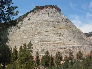 |
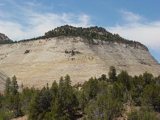
Checkerboard Mesa. |
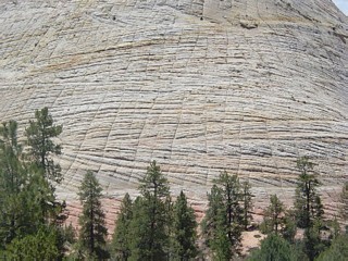 |
Checkerboard Mesa gets its name from the grid formed by the cross-bedding and vertical joint-controlled erosion rills. |
 |
 |
 |
 |
 |
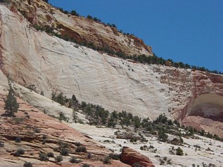
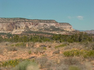
Below: more cross-bedded Navajo Sandstone outside the park. The cliff below displays the cross-section of an entire dune, with top and bottom outline visible. |
 |
 |
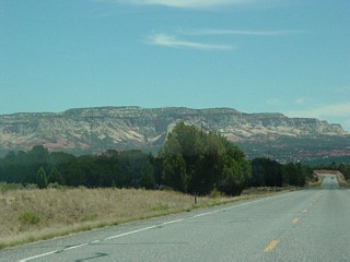 |
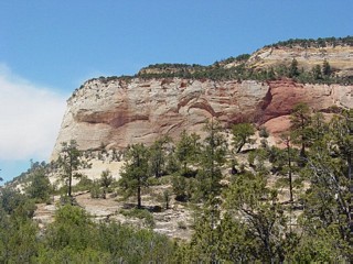
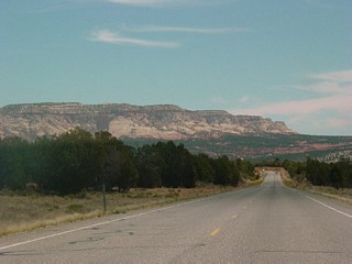
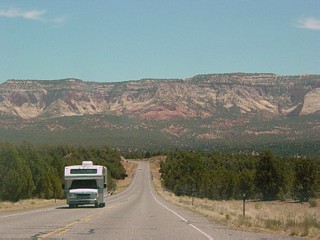
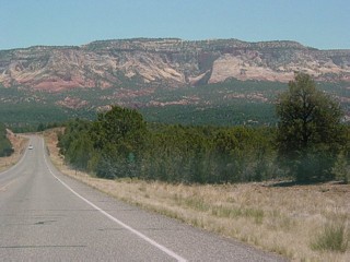
Left and below: Cliffs east of the park near Mount Carmel Junction. Carmel Formation make up the uppermost mesa, with Temple Cap forming the step below and Navajo Sandstone comprising the highest cliffs. Kayenta and Moenave are the red formations below. |
 |
 |
 |
 |
 |
Return to Historic Sites Index
Return to Virtual FieldTrips Index
Return to Professor Dutch's Home Page
Created 7 April 2003, Last Update 10 June 2020