Mount St. Helens, Washington: Spirit Lake and Windy Ridge
Steven Dutch, Professor Emeritus, Natural and Applied Sciences, Universityof Wisconsin - Green Bay
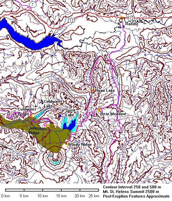
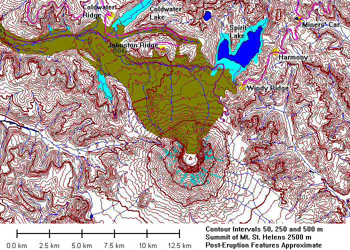
Data for Mount Saint Helens is somewhat ambivalent. The topography availableonline from the U.S. Geological Survey dates from 1981 and shows changes due tothe eruption. But all the other data layers - hydrography, roads, and so, datefrom 1978! Thus the data show the pre-eruption glaciers, outline ofSpirit Lake, and the now-buried course of old state highway 504. On the mapsabove, the buried highway is dark purple, new lakes are light blue and thedebris flow is light brown. Post-eruption data from U.S. Forest Service maps.
 |
Heading east on U.S. 12. From Johnston Ridge to Windy Ridge is 5 miles straight line, over 100 miles and three hours by road. |
 |
 |
 |
 |
 |
|
 |
|
 |
Left and below: the spectacular glacial valley of Clearwater Creek. |
 |
 |
 |
|
 |
Mount Saint Helens hidden by the clouds. |
 |
New growth since 1980. |
 |
Clearwater Creek valley and the edge of the blast area. |
 |
 |
 |
Two miners were killed here during the 1980 eruption. Their car was flung across the road. |
 |
 |
 |
 |
 |
Left and below: views east from the ridge. |
 |
 |
 |
Spirit Lake and Harmony Basin |
 |
 |
 |
 |
 |
 |
 |
 |
 |
|
 |
|
 |
|
 |
Looking east toward Mount Adams |
 |
Old pumice layers near Windy Ridge. |
 |
Windy Ridge parking area. Below: Spirit Lake from the viewpoint. |
 |
 |
 |
 |
 |
 |
 |
Mount Saint Helens |
 |
 |
 |
 |
 |
 |
 |
Mount Adams peeping through the clouds. |
 |
 |
 |
Sharp edge of the blast zone. |
 |
|
 |
 |
Return to Historic Sites Index
Return to Virtual FieldTrips Index
Return to Professor Dutch's Home Page
Created 14 July 2003, Last Update 06 June 2020