Mount Saint Helens: Toutle River Valley
Steven Dutch, Professor Emeritus, Natural and Applied Sciences, Universityof Wisconsin - Green Bay
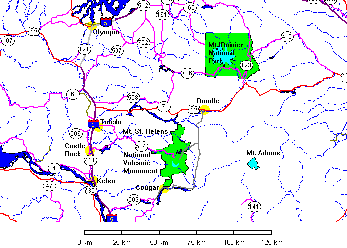

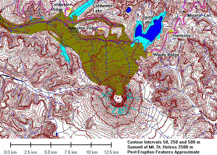
Data for Mount Saint Helens is somewhat ambivalent. The topography availableonline from the U.S. Geological Survey dates from 1981 and shows changes due tothe eruption. But all the other data layers - hydrography, roads, and so, datefrom 1978! Thus the data show the pre-eruption glaciers, outline ofSpirit Lake, and the now-buried course of old state highway 504. On the mapsabove, the buried highway is dark purple, new lakes are light blue and thedebris flow is light brown. Post-eruption data from U.S. Forest Service maps.
 |
October 30, 1994 |
 |
|
 |
|
 |
Successive prehistoric lahar deposits at Coal Creek bridge. |
 |
|
 |
Left and below: 1980 lahar deposits along the Toutle River. |
 |
 |
 |
Sediment Retention Structure. Built 1986-1989 by the Army Corps
of Engineers to trap sediment and prevent clogging of the lower Toutle
and Cowlitz River channels. It is 550 meters long, 56 meters high and
is expected to fill by 2035.
The dam is mostly to catch sediment, not water. It has a series of outlets at different elevations to pass water, and is designed so that upper outlets will drain water as lower ones are clogged by sediment. |
Upper Toutle River Valley
 |
|
 |
 |
The Debris Flow
 |
Looking down the Toutle River. Large landslide blocks are silhouetted in the middle distance. |
 |
Looking toward Mount St. Helens. |
 |
 |
 |
Fragment of glacially polished rock in the landslide debris. |
 |
Tree trunks in the landslide rubble.
Below: the large hills are landslide blocks that were literally shaken to pieces by the landslide. Originally solid rock, they are now mostly disaggregated. |
 |
 |
 |
Note the color boundary on the left side of the hill across the
pond. This is a former lithologic contact, although the blocks have
been shaken so thoroughly they can be dug with a shovel.
Below: looking toward Mount St. Helens. |
 |
 |
 |
Looking down the Toutle River. The river incised about 10 meters since 1980. |
 |
Braided channel of the upper Toutle River. |
 |
Distant view of the landslide. |
Coldwater Lake
 |
Coldwater Lake visitor Center. The road to Johnston Ridge was not yet open in 1994. |
 |
Coldwater Lake from the visitor center. |
 |
The Coldwater Lake landslide dam |
 |
Coldwater Lake looking east |
Mount Saint Helens
 |
 |
 |
 |
Return to Historic Sites Index
Return to Virtual FieldTrips Index
Return to Professor Dutch's Home Page
Created 7 April 2003, Last Update 08 June 2020