North Central Pacific Ocean 45N 170W
Steven Dutch, Professor Emeritus, Natural and Applied Sciences, Universityof Wisconsin - Green Bay
Scale: 1 pixel = 10 km. 10-degree grid; Lambert Conformal Conic Projection, Center 45N 170W
Legend
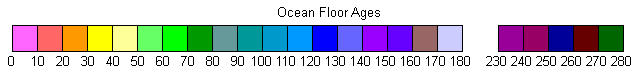
Ocean Floor Ages
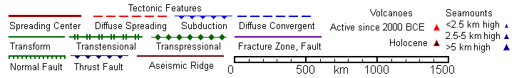
Tectonic Structures
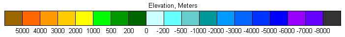
Topography
Land Geology
Discussion
One of the more puzzing facts when plate tectonics first won acceptance is that ocean floor ages increase away from the west coast of North America, instead of decreasing as they do on Atlantic continental margins. The short ridge segment off Oregon and Washington and the disappearance of the East Pacific Rise beneath Mexico explain the anomaly. They are remnants of a once continuous ridge. Age contours older than 30 my extend continuously from the Gulf of Alaska to New Zealand. Before about 30 m.y. ago, a continuous subduction zone ran the entine length of the Pacific margin of the Americas. West of the ridge was the Pacific Plate. To the east was a now-vanished plate, the Farallon Plate. The Juan de Fuca, Cocos and Nazca Plates are remnants of the Farallon Plate.
Also visible are the Hawaiian Islands and Empreror Seamounts. The prominent bend in the chain is about 30 my old, roughly the time when North America first made direct contact with the Pacific Plate. The NNW trend of the Emperor Seamounts probably reflects the original path of the Pacific Plate. Once North America came directly into contact with the Pacific Plate, it began pushing it westward. Since the original path of the Pacific Plate was roughly parallel to the western margin of North America, the Pacific-North American plate boundary became a transform boundary, represented today by the Fairweather Fault in Alaska, the San Andreas Fault in California, and the transtensional Gulf of California.
The bend in age boundaries south of Alaska tells another story. At one time there was an east-west ridge meeting the ancestral East Pacific Rise. Since one ridge was spreading N-S and another spreading E-W, there must have been an additional ridge to accommodate the different spreading directions. North and west of the now-vanished ridges was a plate, now completely gone, which has been given the name "Kula Plate." "Kula" comes from a Tlingit word meaning "all gone."
Return to Global Geology Index.htm
Return to Professor Dutch's Home Page
Created 11 April 2014, Last Update 19 January 2020