Atlantic Ocean
Steven Dutch, Professor Emeritus, Natural and Applied Sciences, Universityof Wisconsin - Green Bay
Scale: 1 pixel = 10 km. 10-degree grid;
Oblique Mercator Projection, Great Circle 50N,170W, 0N,80W. Center 50N 170W
Approximately a great circle from Shanghai to Los Angeles.
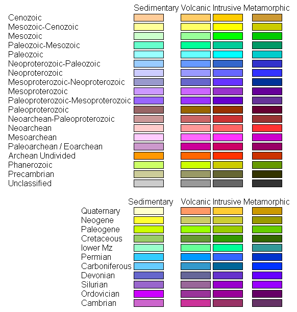
Legend
Ocean Floor Ages

Tectonic Structures

Topography

Land Geology

Discussion
This map shows the subduction zones where the Pacific Plate descends beneath North America and Asia. On the maps that show the Hawaiian island chain, note that the motion of the Pacific Plate is essentially parallel to the west coast of North America but nearly perpendicular to the Eurasian plate margin.
Return to Global Geology Index.htm
Return to Professor Dutch's Home Page
Created 11 April 2014, Last Update 19 January 2020