South America - Africa Transform 00NS 20W
Steven Dutch, Natural and Applied Sciences, University
of Wisconsin - Green Bay
Scale: 1 pixel = 5 km. 5-degree grid. Mercator Projection Center 00NS 20W
Return to Global Geology Index.
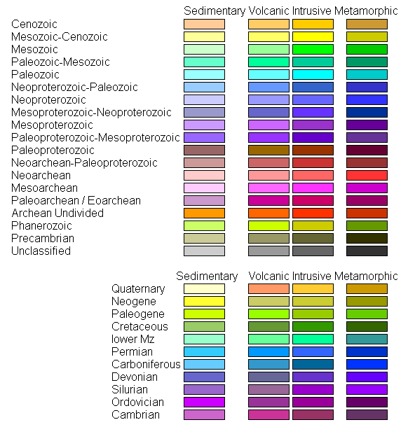
Legend
Land Geology

Ocean Floor Ages

Tectonic Structures

Topography

Discussion
The only map in the collection not centered on some multiple of 30 degrees longitude. It is centered on 20W to center the Atlantic ocean between Brazil and West Africa.
Return to Global Geology Index.
Return to Professor Dutch's Home Page
Created 15 June 2014, Last Update
Not an official UW Green Bay site