Nothin' But Water 45S 150W
Steven Dutch, Natural and Applied Sciences, University
of Wisconsin - Green Bay
Scale: 1 pixel = 5 km. 5-degree grid; Lambert Conformal Conic Projection, Center 45S 150W
Return to Global Geology Index.
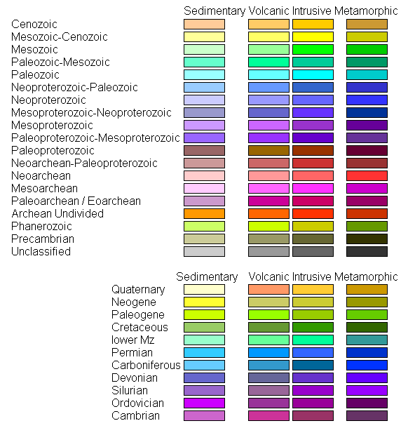
Legend
Land Geology

Ocean Floor Ages

Tectonic Structures

Topography

Discussion
This map shows why a "world" atlas needs a complete set of maps at a common scale. A map sheet in this series measures 4500 by 3600 km, an area of 16.2 million square kilometers, and apart from the Chatham Islands on the far west of the map, there is no land in sight. Other maps of the same size cover the U.S. and much of Canada, and all of Europe.
Return to Global Geology Index.
Return to Professor Dutch's Home Page
Created 15 June 2014, Last Update
Not an official UW Green Bay site